Te Araroa is Maori for The Long Pathway.
The Te Araroa is the world’s newest long trail with a route that takes walkers from the sub-tropical forests and the volcanic plateau of the North Island to the sub-alpine tussock and the passes through the Southern Alps in the South Island.
“It’s open for walking, and there are plenty of trampers going for it, but we’re not claiming it’s finished. Walkers sometimes use back-roads because we haven’t finished the property negotiations, but year by year the percentage of road walking is diminishing.”
These are the words of Geoff Chapple, who has led the idea of the Trail from its inception in 1994.
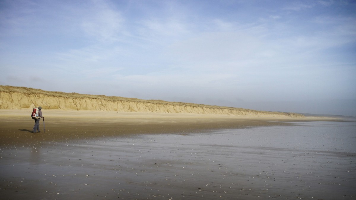
Over 40 through walkers began the 3,030 kilometre tramp during the summer season 2011-2012, and about 15 have finished the four to five month hike. Standouts in the first season’s users were American lightweight hikers. Their packs—without food and water—can weigh as little as five kg.
“They’re teaching Kiwis a lesson in how to move quickly through the wilderness, but the Americans are also learning that a Kiwi trail is different from the aerobic hiking they’re used to. Here they are slowed by steep descents into gullies, and by tree roots or windfall—the average speed through our bush is about 2.5km an hour. They’re also learning that the climate is unpredictable. New Zealand back country, particularly the ranges and mountains, can get four seasons in a day.”
Snow blocks the South Island passes in winter, so the recently published A Walking Guide to Te Araroa suggests starting at Cape Reinga in the north in late spring, and moving into the more rigorous South Island tramp from mid-summer to early autumn, before the snows hit and when river flows are low. There are quite a few river crossing en route, and trampers need patience to wait beside rivers that flood quickly out of New Zealand’s steep catchments—but which drop equally quickly.
Te Araroa Trust lists the really big rivers such as the Rangitata and Rakaia that have braided beds, ie a network of many channels, kilometres wide, as hazard zones. Crossing is not recommended, and trampers need to pay for a jet boat ride or simply hitch around to the far bank. Aside from passing through hundreds of kilometres of wilderness, the trail has its social side.
“We go through 70 settlements, and most of them are getting a buzz out of the exotic international walkers passing through,” says Chapple. “We decided early on that there was no way the Trail could avoid all the cities. Auckland for instance spreads wall to wall across the Tamaki Isthmus, so we simply chose a green route across its parks and over the extinct pocket volcanoes in the city. It’s not wilderness, but maybe you’ll get an invite to a barbeque! That’s just social fun, and then within a day or two you’ll be back on hill tracks and not see anyone for days.”
The Government planned a long trail in the 1970s but that effort lapsed without even a sufficiently planned route. Chapple’s article in a Sunday newspaper restarted the idea in 1994. He named it Te Araroa, the Long Path and then led the trust that finally brought it through to its opening on December 3rd 2011.
Chapple sums it up thus:
“It’s a citizens’ trail with hundreds of volunteers. First up there was just a bunch of crazies who thought it could be done. We designed the proto-trail with some rough bush bashing action. Then more and more keen people started taking notice. Later the Department of Conservation and the councils got behind it, and their effort has been important. But it was a citizens’ effort. The Trail got pulled up by its bootstraps, and now we’re into the fourth stage —track improvement and maintenance—and a Kiwi welcome to the hardy souls en route. The walkers and the magic of the land is what it’s all about.”
For more information visit http://www.teararoa.org.nz