Northcliffe
Between Northcliffe and Walpole, walkers heading south will once again reach a few milestones; the diverse ecosystems of the Pingerup Plains, the last of the campsites with campfires permitted (outside the bushfire season) and, most significantly, the first encounter with the wild southern ocean.
This is the second longest stretch of the Track between resupply points and passes through some very remote terrain. South of Northcliffe, walkers are rewarded with a wide variety of vegetation; karri forest, jarrah woodland, paperbark swamps, low shrublands and swampy sedgelands. While the distribution of vegetation types may appear haphazard, there is in fact a pattern that relies on the underlying soils and landforms.
Karri grows almost exclusively on red loam while jarrah prefers sandy pea gravel (laterite) with both forest types occurring on higher ground. Most of the shrublands occur on low-lying, poor, sandy soils that are often waterlogged in winter. These often fringe swampy sedgelands, located on perpetually wet, infertile, sandy peat, and come ablaze with splashes of brilliant vermillion in autumn when the swamp bottlebrush is in flower.

The soils of the south west were formed over many millions of years by a complex interplay of environmental forces and the weathering of the underlying rock. Batholiths (granite domes) are the remnants of gargantuan events that occurred millions of years ago beneath the surface of the earth. Extreme temperatures caused areas of rock, generally granite, to melt and be pushed upwards by immense pressure, like gigantic bubbles. Eventually these solidified below the surface but subsequent erosion over the millions of years has left these dome-like structures exposed above the surface. As one moves eastwards the occurrence and size of these granite outcrops increases. On the Pingerup Plains and the Woolbales Hills they become the dominant features.

Southwards and eastwards the Track crosses increasingly flat and lower lying terrain. Some stretches in D’Entrecasteaux National Park are flooded up to knee deep between July and November. The Park is named for Rear Admiral Joseph Antoine Bruni D’Entrecasteaux, whose expedition explored the Australian coast in the 1790s. There, the Track continues east and crosses the Shannon River at Dog Pool, a lovely camping spot amongst the karri. Winter rainwater slowly drains across the flat landscape into beautiful Lake Maringup, the second largest freshwater lake in WA, and via the Shannon and Inlet Rivers into Broke Inlet which is the largest, most pristine inlet of the south coast.

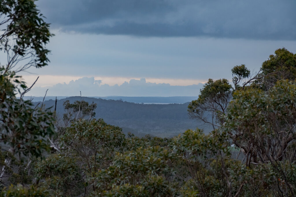
Walking from Woolbales towards Walpole a growing sense of expectation builds with the proximity of the coastal cliffs, bluffs, beaches and the wild ocean beyond. At Mandalay Beach walkers from the north catch their first glimpse of the Southern Ocean with Chatham Island looming large. The beach is named after the Norwegian barque “Mandalay” that was wrecked just out to sea in 1911. Very occasionally, when the tide is right, the wreck can be seen, its timbers poking forlornly out of the water.

Nyoongar Aboriginal people had long referred to this area as Nor-Nor-Nup, the place of the Norne or black snake. Sealers and whalers were the first outsiders to arrive on Walpole’s coast in the early 1800’s. Their glowing reports of sheltered inlets, deep rivers and huge trees brought several explorers into the area, which they named Nornalup Inlet.

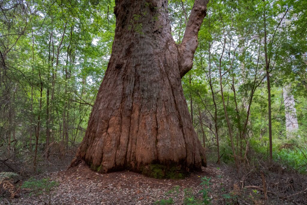
On the way to Walpole, the impressive granite cliffs of Long Point and Point Nuyts are seen, before walkers cross Nuyts Wilderness, Deep River and the tingle clad Mount Clare. The natural occurrence of four species of rare eucalypt is restricted to the Walpole vicinity. In addition, the forest holds three species of tingle trees; the yellow tingle, the Rate’s tingle and the red tingle. The larger specimens of tingle are more than 400 years old and attain a great size. The massive red tingle trees are encountered for the first time at Mount Clare, before the Track descends to Walpole.
“… the most romantic (scenery) I ever witnessed in the other quarters of the globe”—Scotsman William Clark describing Walpole in 1841.
For more information on walking from Northcliffe to Walpole go to the Section by Section Guide.