Jim Baker, Perth, WA
Phu, Nar and Tilicho are in the Annapurna region of Nepal. Phu and Nar are remote villages, and Tilicho is the highest glacial lake in the world. Reaching them involves some strenuous walking up to an altitude of 5300 metres.
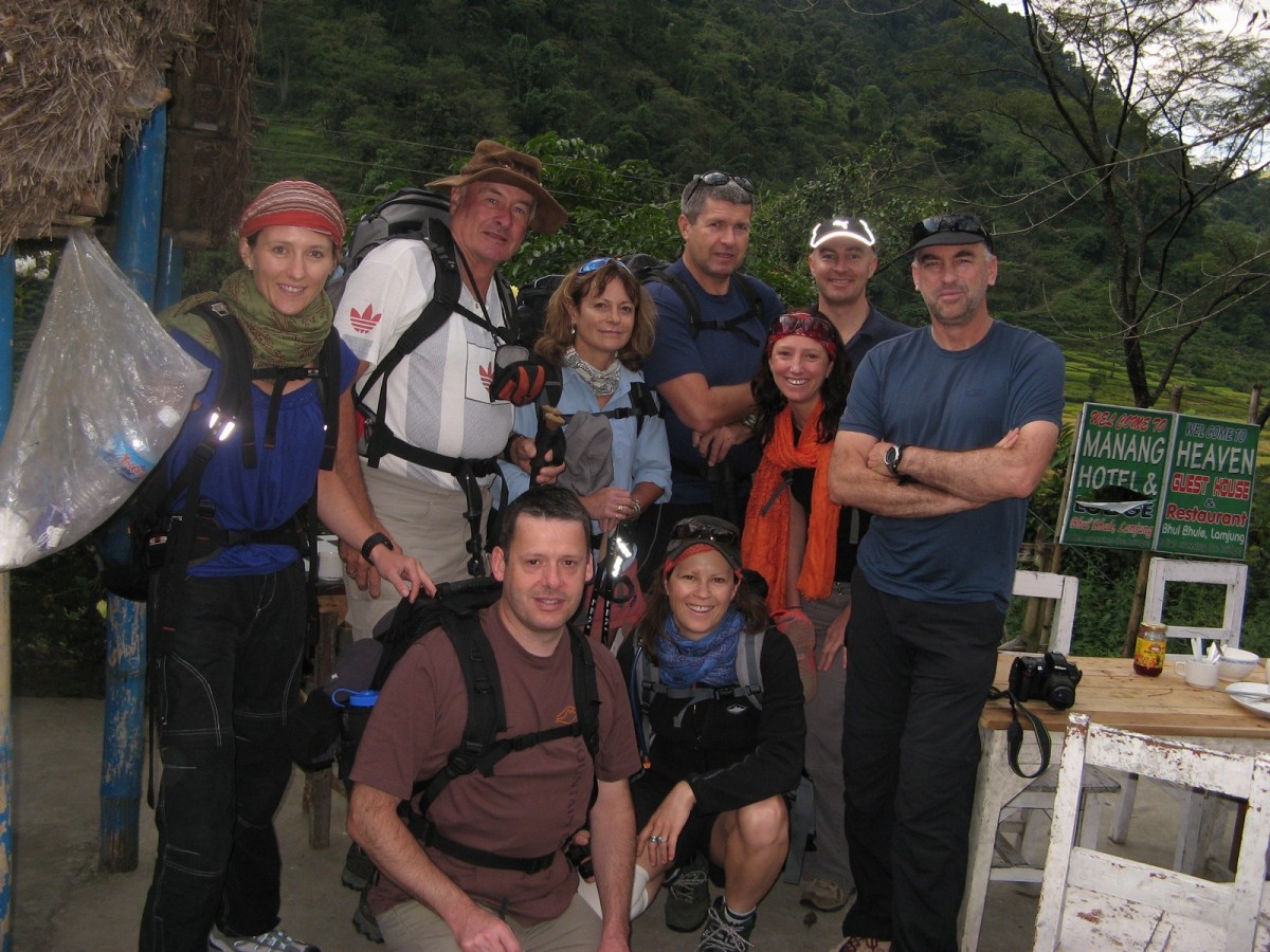
The group assembled in Kathmandu and was transported by bus to Bhulebhule on the Annapurna circuit. The bus driver was a hero, driving over virtually impassable roads and negotiating with teenage wannabe terrorists who tried to hold us to ransom. The first three days saw us on the Annapurna Circuit, staying in lodges and climbing steadily as we acclimatised slowly to avoid the possibility of altitude sickness. Not easy walking by any means with some tough climbs.
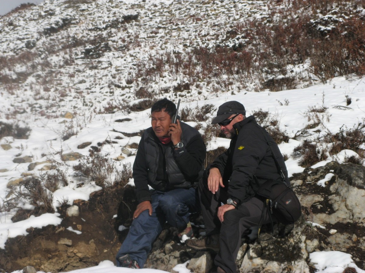
Our Sirdar for the trek was a wonderful character called Dorgee. The Sirdar is a Sherpa who takes responsibility for obtaining the porters and other means of transport, dealing with the local people along the way, buying food, organising accommodation and dealing with all the logistics of the walk. Dorgee is a remarkable man, immensely fit and strong, with boundless energy and a great sense of humour. Not only did he ensure the smooth running of the whole trek, he found time to entertain us in the evenings with stories about Yetis and also explained a great deal about the history and the politics of Nepal.
Dorgee’s chief henchmen were two Sherpas, Kazi and Bikazi and the cook, Lakba. All of these guys worked tirelessly and did everything in their power to look after us. That, plus the highly professional leadership of our group provided by Mike Wood meant that the walk ran as smoothly as possible, although as is often the case on a trek of this nature, the unexpected did occur, as you will see.
The Annapurna Circuit was overcrowded, with people and horses everywhere, and it was with a sense of relief we turned off the beaten track on day four. By now we had climbed to about 2800 meters in three days and the day’s walk would take us up another 500 meters or so. The itinerary for the trek had been thought out carefully, with contingency days built in, which enabled Dorgee and Mike to adopt a day by day policy with regard to the distances walked and the altitude gained.
The villages of Phu and Nar are situated in beautiful valleys to the north of the Annapurna circuit, close to the Tibetan border. The area has been open to foreign trekkers only since 2002 and has been visited by few westerners. Our route took us through some bleakly beautiful countryside, with the mighty snow covered peaks of the Annapurna standing like sentinels all around.
Many of the buildings we saw appeared long deserted and the disused terraces of fields were arid and grey. It was windy and dusty. The weather so far had been pleasantly warm, but now, although the sky was still blue, there was a razor edge on the wind, and the nights were becoming cold. Lodges had become a thing of the past and tents were our accommodation.
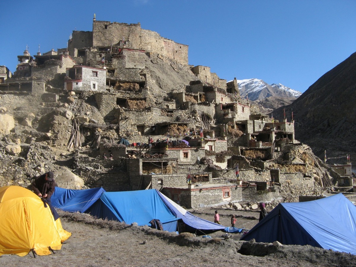
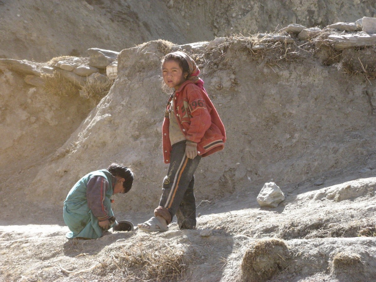
On November 3rd we walked into Phu, and the first sight the village made me stop, close my eyes and look again. Remember, we were now almost 4000 meters high, and people have been living here for thousands of years. Up until a few years ago, this has been one of the most isolated communities in the world, and people here live under some of the harshest conditions on Earth. The people in this region are ethnically more Tibetan than Nepalese; their dialect is related to Tibetan and they have had far more contact with nearby Tibet over the centuries than with the Nepalese.
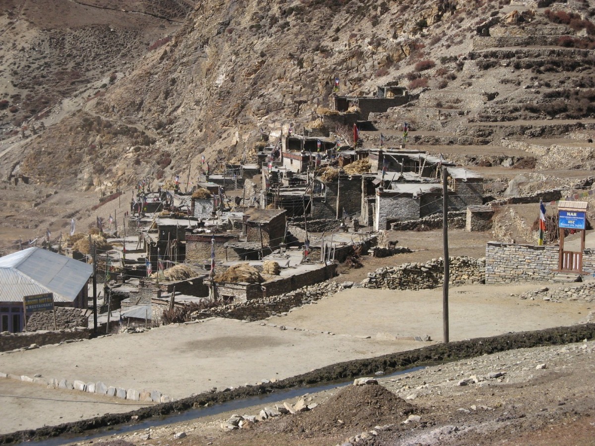
The village is built like a vertical jigsaw puzzle and dominated by the fort, which looms heavily above. One man’s roof is another’s front yard, and the villagers live in harmony in what to the western mind is a bizarre setting. The village is set on a hill and is itself dominated by the monastery, set high above and behind the fort.
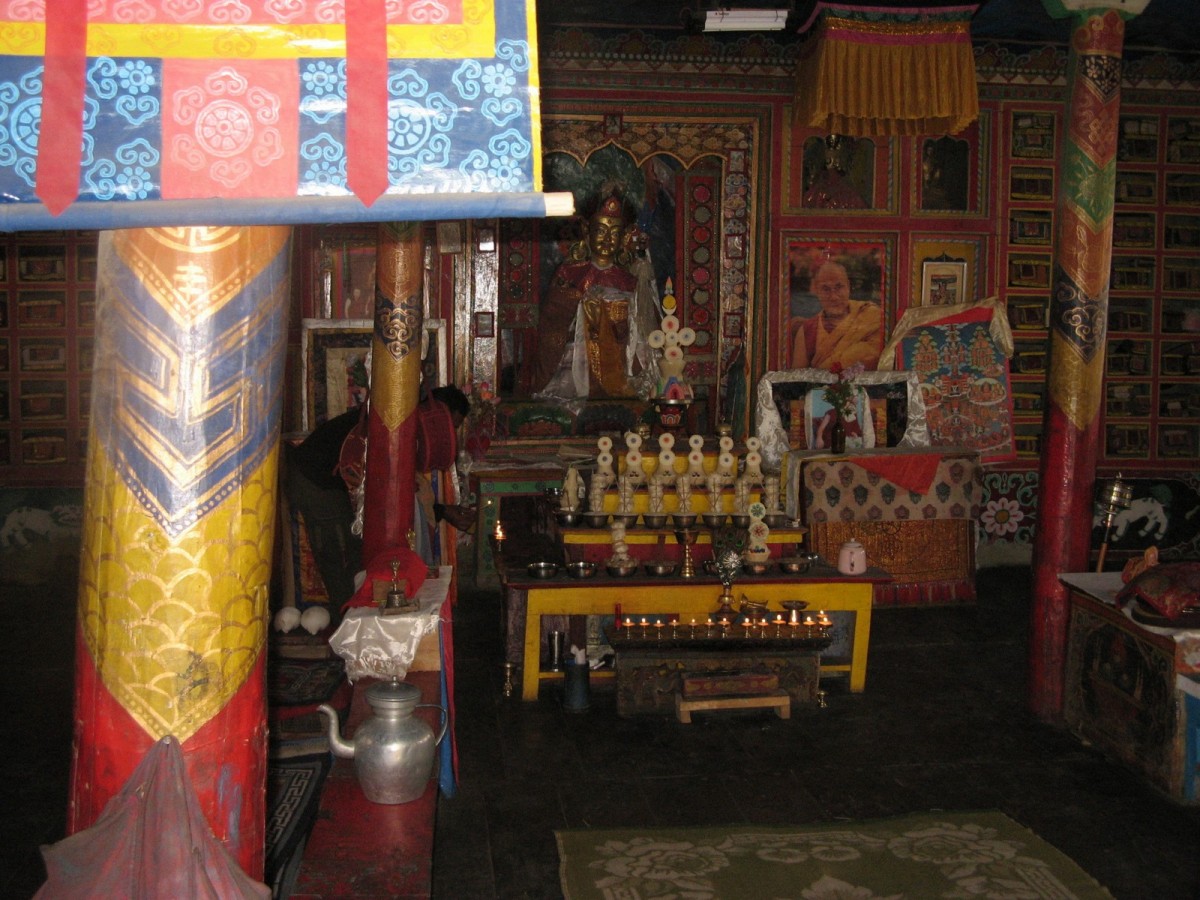
We took a rest day at Phu and visited the monastery and the fort. It was sad to see that the fort is in a state of disrepair, but there are few people left now who remember the history of the area, and survival in the harsh conditions takes precedence over heritage. A locked room contains statues of unknown antiquity and significance, visible through a narrow slit in the wall.
From Phu, we moved back down the valley towards the village of Nar, dropping from 3980 meters to 3560 meters, and then into Nar itself the following day, at 4130 meters. It was at this time we began to understand Dorgee’s terminology.
After dinner each day Dorgee would explain the format for the day to come…how far, how high, the weather, what to wear etc. However we soon got to understand that his interpretation of time and altitude didn’t quite match ours. For example, “we’ll be there in two hours” usually meant “for the quick guys, allow four”. “Tomorrow will be a little bit up and down” meant “get ready for a semi-vertical slog” and “a bit up” translated as “if you think yesterday was tough…”
The village of Nar is less isolated than Phu and has mod-cons—electricity, irrigation and some modern buildings. The villagers are more used to trekkers and the modern world is slowly closing in.
From Nar we climbed to 4650 meters and camped overnight, and then took on the Kangla Pass, at 5300 meters, the highest point so far on the trek. The climb to the top was not too difficult—frozen snow on a zigzag trail that eventually brought us to the prayer banners at the top of the pass. The descent was hair- raising; almost two kilometres of scree running down a precipitous slope to the village of Ngawal.
The mood of the group was buoyant at dinner—we thought we’d completed the toughest day that we could expect. Little did we know…
The next two days were short and easy, taking us firstly to Braga, where we had the luxury of a hot shower, and then on to the lodge at Khangsar, at 3750 meters. From here, our itinerary allowed for two days to reach Lake Tilicho, and then a further two days to cross the high Eastern and the Meso Kanto Passes. The weather, however, was beginning to deteriorate and snow was forecast at higher altitude. The choice was either to return the way we had come, or to press on rapidly and get across the Meso Kanto Pass in two days rather than four.
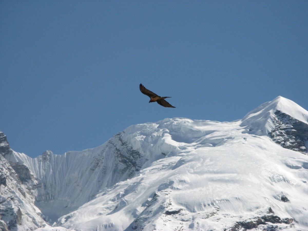
The following day we set off early to reach Lake Tilicho at 4990 meters—a gain in altitude of 1240 in the day. Comfortable walking took us to Tilicho Base Camp for lunch, and then we tackled tougher sections of track through the scree. The horses could go no further, and our baggage was now being carried by Dorgee, the Sherpas and a selection of porters who could handle heavy loads at high altitude. Shortly before dark we reached the frozen snow covered plateau and then the lake itself. The scenery along the way was spectacular, and the lake quite surreal—the pictures speak for themselves.
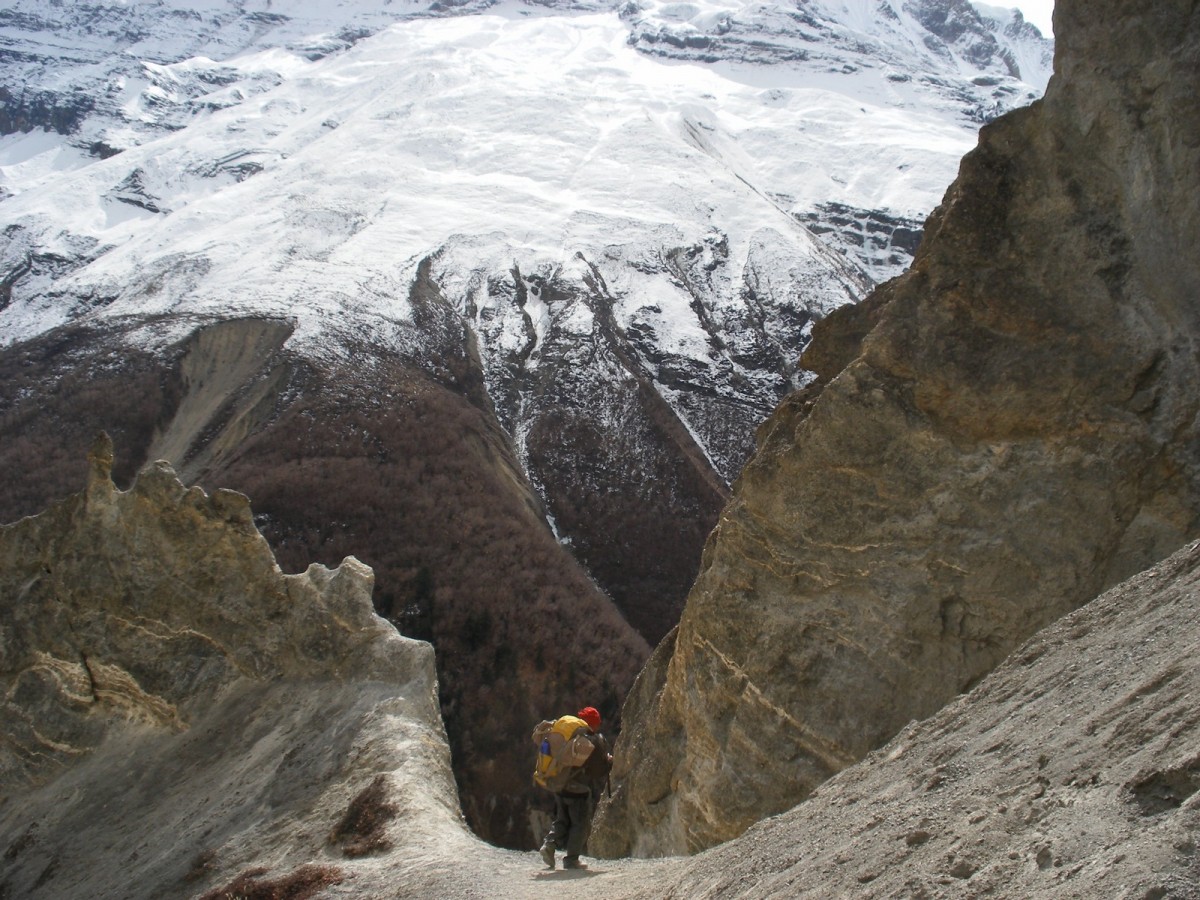
We camped in the snow beyond the lake. The cold was intense, the wind strong, there were flurries of snow and the following morning we woke to find light snow falling steadily. We left early and trekked up to and over the Eastern Pass on narrow, icy trails to an altitude of 5350 meters. Once across we descended into the saddle, where the snow was knee-deep, and then up the long, hard ascent to the tall tower of rock marking the top of the Meso Kanto Pass.
The weather by now had deteriorated to blizzard conditions with the high winds blowing the snow horizontally. From the shelter of the rock we peered over the top of the pass. The scree had long vanished and stretching away was a very steep slope of pristine white snow. I looked at the other members of the group and sensed a clear, unspoken question—“how the hell are we going to get down there?”
.jpg)
The question was quickly answered. A rope appeared, and soon we were descending slowly, hanging on grimly and slamming our boots into the deep snow to gain purchase, until the slope levelled out. Not surprisingly there were no photographs taken of this episode. Hanging on to a rope in a blizzard with your hands freezing inside your gloves does not encourage the use of a camera.
We walked on until dark and camped just above the snow line. Two of our five tents had to be left at the top of the pass, and three bags of personal gear were dropped during the descent. This was when our Sherpas and porters really excelled themselves. Despite the rigours of the day they went back up the pass the next morning and recovered almost all the lost material. The strength, stamina and character of all these guys cannot be over-emphasised—without people like Dorgee and his team treks of this nature would be impossible.
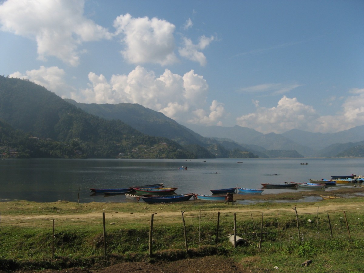
The long descent to the town of Jomson the next day marked the end of the trek itself and a return to a life of soft beds, flush toilets, hot showers and cold beer. Because we had covered the final part of the trek more rapidly than planned we now had time to kill, and so spent a relaxing few days in Jomson and Pokhara, before flying on to Kathmandu and then back to Perth.
The trek was a huge success. The members of the group worked well together and accepted the problems and difficulties with good humour. The walk was physically demanding, as we had been warned, but all the drawbacks were handled efficiently. The whole programme was well thought out and we were very well looked after by all the professionals involved.
All in all it was a privilege to be able to visit a part of the world that few people have seen and to enjoy some of the most fantastic scenery the Himalayas have to offer.