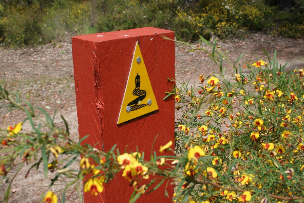
The Track is for walkers only and is signposted with yellow triangular markers symbolising the Waugal, the rainbow serpent of the Aboriginal Dreaming. Trail markers are spaced up to 500m apart. They are more frequent when there is an intersection with other tracks or when the Track takes a turn. For more information about the Nyoongar culture please see the various Along the Track pages and visit Nyoongar Knowledge.
Nyoongar people are known and acknowledged as the traditional owners and custodians of the land and waters over which the Bibbulmun Track passes. Nyoongar people have a deep spiritual, emotional, social and physical connection to “country” (Boodja). Nyoongar people ask you to please respect the Boodja when you walk the Bibbulmun Track to ensure its natural and cultural values are preserved for all future generations.
The Track takes walkers through towering karri and tingle forests, down mist-shrouded valleys, over giant granite boulders and along breathtaking coastal heathlands. It passes through many of the most beautiful national parks of the south west forests and coastline.
The Bibbulmun Track offers a wide range of experiences, from a gentle stroll to enjoy the peace and beauty of the natural environment, to an epic eight week adventure. Those that walk every step of the way can be registered as end-to-enders.
You can make it a wilderness experience by camping out, you can join a guided group, a tour, or you can do it in comfort by staying in the towns along the Track and enjoying day walks in the area. The Track passes through Dwellingup, Collie, Balingup, Donnelly River Village, Pemberton, Northcliffe, Walpole, Peaceful Bay and Denmark.
The Bibbulmun Track is essentially a linear walk; you will need to do some planning if you don't want to retrace your steps. This might involve arranging a car shuffle, swapping keys as two groups meet at a campsite, or having someone drop you off and collect you at the other end. Many of the Track Towns are accessible by public transport. See the Section by Section Guide for more details on getting there.
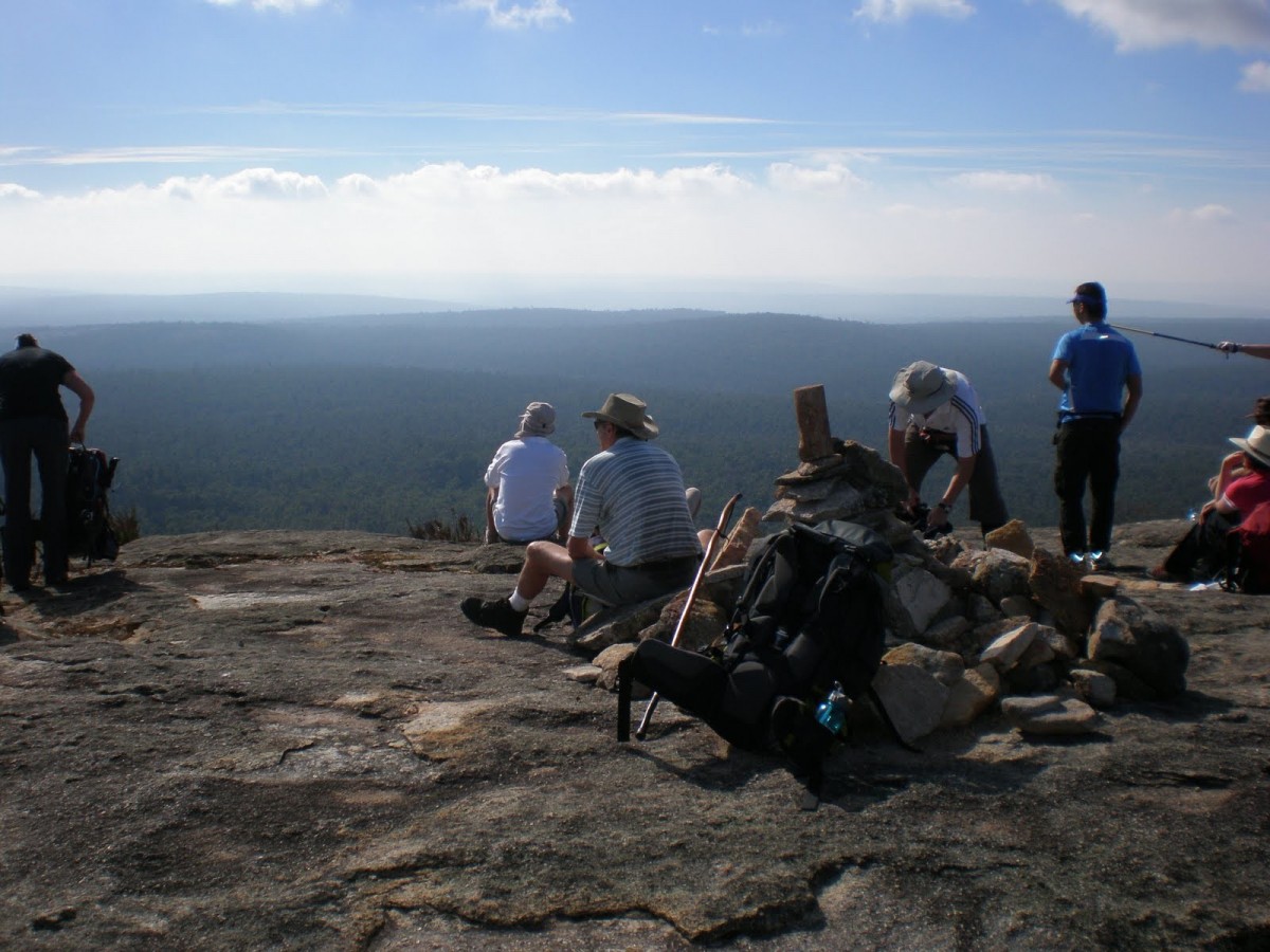
In addition, there are several facilities designed to enhance the walker's experience. Boardwalks, well positioned lookouts and footbridges all form part of the trail.
The best times to walk the Track are in autumn (April to May), winter (June to August) and indeed spring (September to mid-November), our wildflower season. On cooler days, walking during summer is possible but certainly not recommended and should be restricted to the karri forest around Pemberton.
Walkers should visit the FAQs and the Trip Planner pages before walking the Track for the first time and then check the Track Conditions prior to every walk. Sections may have diversions or closures which may affect the best plans.
Maps and new Guidebooks
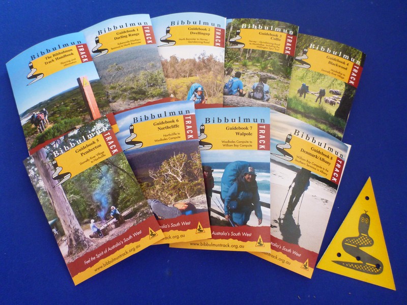
The eight new corresponding compact, pocket-sized and informative Guidebooks (published by the Foundation) each contain a plethora of information for each map section including:
- Track Town information,
- suggested day and overnight walks,
- Track tips,
- section by section descriptions,
- vehicle access to each section,
- reflections from the campsite registers, and of course,
- new, improved and more detailed Track notes.
In addition, the Bibbulmun Track Handbook contains general Track information, planning, safety, history and management information.
Maps and Guidebooks are available from the Foundation, the Parks and Wildlife Service, equipment stores and some visitor information centres. See all our merchandise.
Track facilities
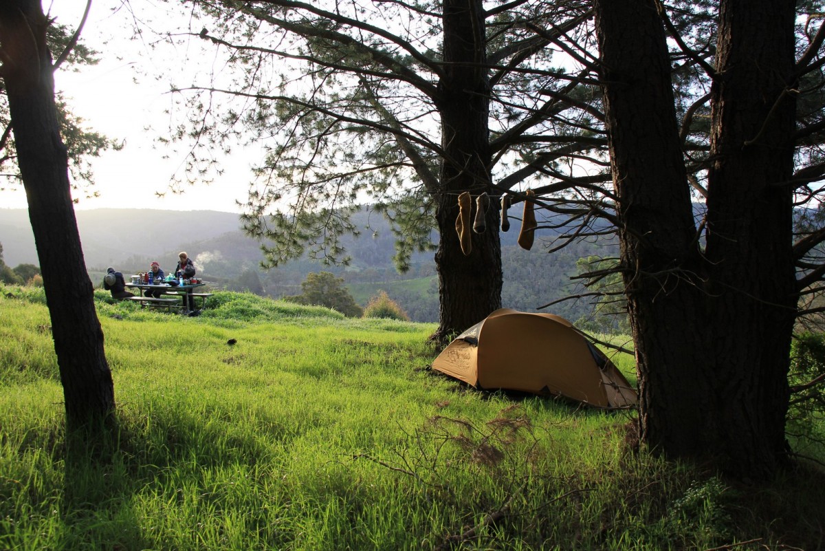
There are 49 campsites along the Track, which are spaced a day's walk apart. In the far northern section, between Kalamunda and Brookton Highway, they are approx. 10km apart due to proximity to population and high usage. Further on they are around 12-25km apart.
Each campsite has:
- A three-sided timber shelter.
- A sit-down pedestal pit toilet (BYO toilet paper)
- Rainwater tank.
- Picnic tables.
- Tent sites.
In addition some have a fireplace. See the section on fires below.
Currently all Track facilities are free and offered on a first come, first served basis. However, groups of more than eight may not occupy a shelter before 6pm (see Code of the Campsite). If you are travelling in a group of eight or more, then please also see the Notice of Intent page.
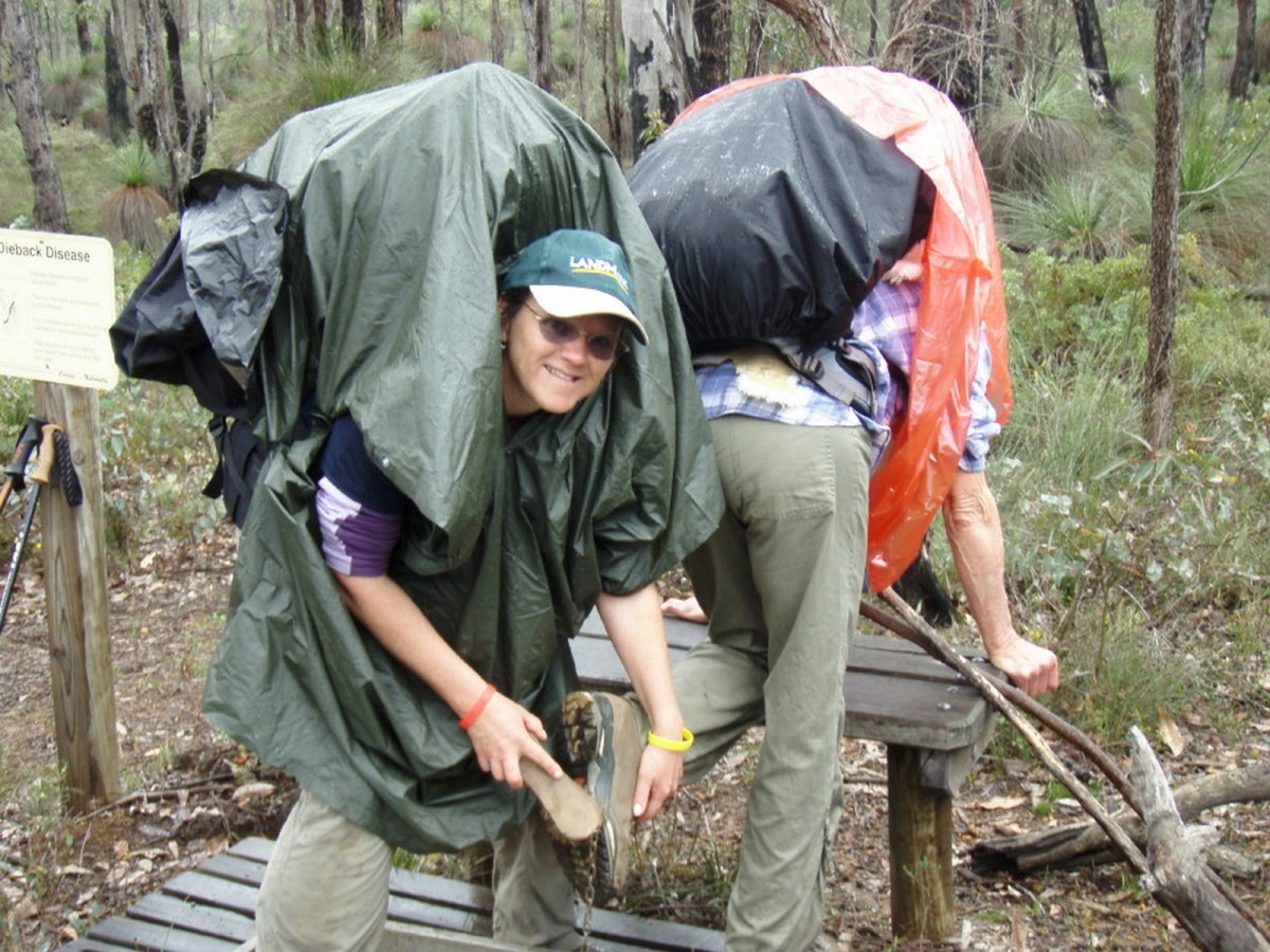
In case the shelters are full, all walkers are advised to take a tent or bivvy bag. Alternatively, if you don't want to carry a full pack or camp out on the Track, there are nine towns along the way offering a wide range of accommodation. For overnight pack free walking, staying at accommodation, see our Bibbulmun Walking Breaks. See also the Frequently Asked Questions. It is not possible to walk consecutive sections of the Track as day walks - the towns and accommodation providers are just too far apart and permitted access points are very limited in some areas.
Using the facilities
Shelters
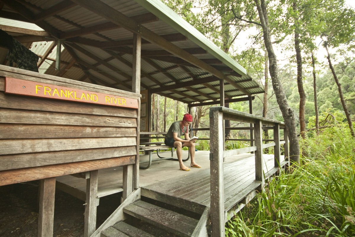
There are several basic shelter designs. All of them are simple and robust, built of natural timber and iron, and are completely open on one side. This feature allows the tired walker, enjoying a moment's relaxation after the pleasant exertions of the day, to take in the tranquillity and beauty of the forest and bush while preparing an evening meal or just resting with a book.
Many of the shelters were prefabricated in a prison workshop, as part of a joint venture involving the former Department of Conservation and Land Management (now the Parks and Wildlife Service) and the former Ministry of Justice (now Department of Corrective Services). They were then transported to the site and erected, often by groups of volunteers.
One of the shelter designs, the Deep South, has a broad verandah at the front, providing protection from the colder and wetter conditions that can be encountered in the south. This design is also used where there tends to be high levels of group usage, as it provides a greater area under cover.
The Nornalup, erected mostly on the south coast and in the southern forests, is the largest of all, with sleeping space for around 15 hikers.
An added feature of the Brookton campsite is that the standard shelter and toilet designs have been appropriately modified to allow access and use by people with mobility disabilities. The site is linked to the Brookton Highway by 2.5 kilometres of wheelchair accessible trail, enabling hardy, outdoor orientated people with disabilities to share in the magic of the Bibbulmun experience.
Tent sites, toilet and picnic tables
All campsites contain at least two picnic tables, with one being under the cover of the shelter.
The Bibbulmun Track campsites also boast simple and neat bush toilets. These small buildings were prefabricated in one of the State prisons, and great pains were taken to ensure that some of them were located to give their occupants some fine outlooks over surrounding bush, or the campsite nearby. Don't forget to bring your own toilet paper!
Free camping
No camping (free camping) is permitted between Bibbulmun Track campsites, where there is no official designated campsite, in National Parks, Conservation Parks or Nature Reserves. This also applies to water catchment areas - ie most of the Track between Kalamunda and Collie, and south of the Blackwood River.
Water
Summers in Western Australia are long and hot, with little or no rain for months on end, so it is absolutely vital that all walkers conserve water and use this precious resource appropriately. The shelter roof acts as a catchment for the all-important rainwater tank located nearby. They are not filled by any other means.
The availability or purity of water at campsites cannot be guaranteed, especially in summer. We recommend that walkers treat the water in the tanks.
Walkers should not expect to find water in most of the streams and watercourses shown on maps - many are seasonal and flow for only brief periods after rain. Therefore, it is important to carry at least the minimum water needs for your entire day's walk. At the height of summer, this can be four litres or more per person per day.
Fire
A campfire ban is usually in place from the end of October to March each year. Total fire bans may also be in place. Check the Track Conditions on our site before you walk.
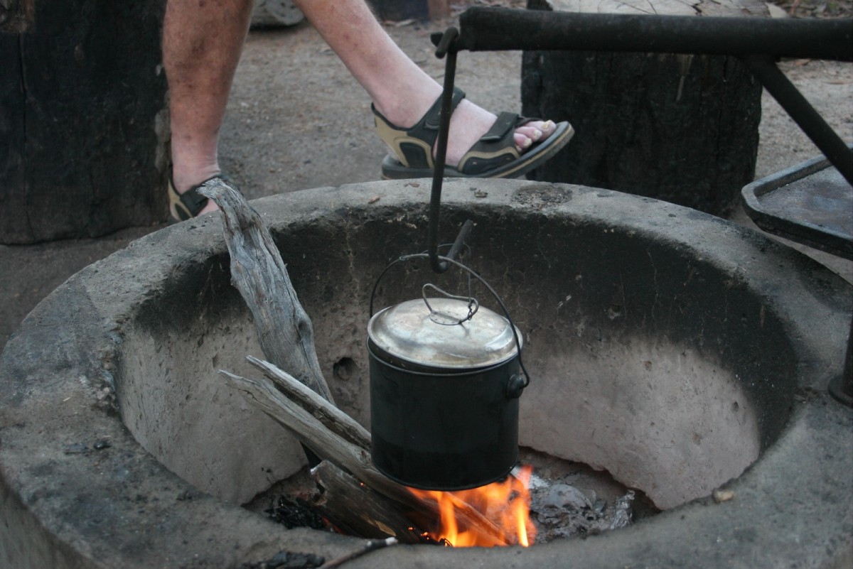
A number of campsites on the Track are designated no fire sites. This is usually to preserve fragile and important surrounding vegetation, and we ask that you respect this request and use your fuel stove. Indeed, it is sound practice always to use a fuel stove, thereby preserving the visual and environmental qualities surrounding the campsites.
Campsites where fire is not permitted at any time are the Yourdamung and Blackwood campsites in the northern half of the Track and all campsites to the south and east of the Shannon River in the southern half, ie Mt Chance campsite to Albany. These are permanent no fire campsites where only fuel stoves are to be used for cooking.
To help preserve the environment and due to the increasing lack of firewood, use of fuel stoves for cooking is encouraged at all campsites. However, if you do choose to light a wood fire, keep it small and remember the old Aboriginal saying: "White man make big fire, sit far away - black man make small fire, sit close."


