Track Conditions
Current Track conditions
Conditions on the Track change almost daily and walkers must stay abreast of these impacts. Walkers should always check the current Track conditions before embarking on a walk.
The current Track conditions appear within the Section by Section guide. Select the section that you intend walking and then the Realignments/Diversions tab, Inlet Crossings, Groups on Track and other tabs for more information.
The Bibbulmun Track often has temporary diversions and realignments for various reasons, which can extend the distance to be walked on any day. If you come across such a variation, follow the trail markers as opposed to your map. The Track will soon re-join the trail indicated on the map.
During bushfire season, usually (but not limited to) December to March, where conditions can change very rapidly, we will update our website as soon as possible. However, we urge walkers to check Emergency WA for bushfire impacts, fire danger ratings and total fire bans. Walkers should also check Park Alerts for impacts specifically on the Bibbulmun Track.
We ask that walkers reconsider heading out on extended walks during the summer and warmer months.
Temporary diversions
Temporary diversions are marked out on the Track with Waugal trail markers on a yellow metal post. Check the Section by Section guide for details on the diversion.
If a campsite is closed then a temporary campsite will be provided, with a temporary toilet and water tank only. As there are no shelters at these campsites, walkers will need to use their tents.
Permanent realignments
For various reasons the Track may be permanently realigned so that what is shown the map differs from what is in the field. Follow the Waugal trail markers as opposed to your map or guidebook. The Track will soon re-join the trail indicated on the map. All realignments are detailed in the applicable section in the Section by Section guide with the new distance to be walked.
Inlet crossings
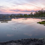
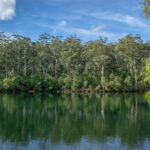
On the south coast, the Track crosses a number of inlets. Often these inlets are closed to the sea by a sandbar but occasionally the sandbar is breached (sometimes naturally by heavy rainfall or by the Water Corporation to lower the level of the inlet). When the sandbar is breached, waters can flow dangerously fast. Walkers must be prepared to follow lengthy alternate routes or find alternative sections to walk in these instances.
The details and latest information of the Irwin and Parry Inlets can be found on the Walpole Section by Section guide.
The details and latest information of the Wilson and Torbay Inlets can be found on the Denmark/Albany Section by Section guide.
Groups on Track
Leaders of groups should notify the Foundation of their intention to stay overnight at any Bibbulmun Track campsites, using a Group Notification form.
Leaders should note that groups walking the Track and staying overnight night at Bibbulmun Track campsites should not exceed 17 in total.
Campsite shelters cannot be used by groups of more than 8 until after 6pm. Individual walkers have priority over groups in the shelters. See the Code of Campsite and the Leave No Trace principles.
All groups should obtain a Group Notification form and submit it one month before they intend to depart for their walk.
For the list of group overnight campsite usage please the Groups on Track tab in the relevant Section by Section Guide under Trip Planner on our website.
Prescribed burns
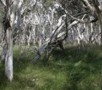
The Parks and Wildlife Service conducts a program of prescribed burning operations during spring and autumn each year. Prescribed burning operations are undertaken for a variety of reasons, including property protection, fuel reduction and biodiversity management.
These burns are carefully planned however they may cause disruption to walkers. Where prescribed burning operations impact on the Track, temporary diversions will be put in place. Where the Track is diverted, walkers should follow the Waugal trail markers on yellow metal posts. Walkers should always adhere to instructions on signs posted on the Track for their own safety. Prescribed burning operations are dependent on appropriate weather conditions and as such, dates for operations are not available in advance.
As soon as we know a burn is about to take place, we will post the information on the diversions section of the relevant Section by Section guide. You can view all active burns on the Parks and Wildlife Service website.
Campfire bans and total fire bans
A campfire ban is usually in place on the entire length of the Track each year from the start of summer to mid April. The start dates of the campfire bans vary a little for each section so walkers should check the Track conditions in the relevant Section by Section guide. All walkers must carry their fuel stoves to cook meals when staying at these campsites during the campfire ban season.
In some rare instances there may also be a total fire ban at all campsites which means that even portable fuel stoves may not be lit.
Just a reminder
Please remember that the Bibbulmun Track is a walking track only. No wheeled vehicles, including trolleys/hiking trailers, wheelbarrows, prams and bikes should be on the Track. Please help to preserve the Track and the environment by keeping to ‘boots only’. See our FAQs for more information.
Dieback and Bibbulmun Track access
Please help stop the spread of Dieback which is killing our forests. If there is no red or green car on the road shown on the Bibbulmun Track Map, then you are not permitted to drive on that road. You may be prosecuted if your vehicle is found in Disease Risk Areas – read your map carefully. If you have any doubts contact us. Note that green cars mean that you must walk to the Track from an access road. See our FAQs for more information.
People are often not aware that they are in DRA. As a guide (but not limited to) check the table below.
Remember, no red car = no access.
For areas not listed please contact us.
Watch a short video on Dieback.
| Darling Range | Kalamunda to Mundaring Weir | Access only at red cars marked on the map. Fern Rd, Paulls Valley Rd, Asher Rd, South Ledge, Mundaring Weir Rd and the Perth Hills National Parks Centre on Allen Road (no access beyond the Centre). All other roads are in DRA – no legal access permitted. |
| Mundaring Weir to Brookton Highway | Only Dale Rd. Allen Rd and other associated roads from beyond the Perth Hills National Parks Centre (Hills Forest Discovery Centre) to Dale Rd are all in DRA – no legal access permitted. | |
| Brookton Highway to Albany Highway | Only Brookton Highway, Sullivan Rock spur trail and Albany Highway. Kinsella Rd, Mt Cooke pine plantation, Cowcher Rd/Albany Highway and Coach Rd/Albany Highway – access via walking on the these roads to the Track only. | |
| Albany Highway to Dwellingup | No vehicle access from Albany Highway to Chadoora campsite. Inglehope Rail Crossing is the only vehicle access between Albany Highway and Dwellingup. All other roads are in DRA – no legal access permitted. | |
| Dwellingup | Dwellingup to Harvey-Quindanning Rd | Nanga Rd, River Rd, Yarragil Form, Driver Rd and Harvey-Quindanning Rd only. All other roads are in DRA – no legal access permitted. |
| Harvey-Quindanning Rd – Collie | Harvey-Quindanning Rd, Harris Dam picnic area, Allanson Rd, Mornington Rd and Coalfield Highway only. No access permitted from Harvey-Quindanning Rd to Harris Dam picnic site including Possum Springs campsite to Harris Dam campsite. All other roads are in DRA – no legal access permitted. | |
| Collie | Collie to Mumballup | Only Mungalup Rd bridge, Mungalup Rd south, Glen Mervyn Dam and Mumballup (Donnybrook-Boyup Brook Rd). All other roads are in DRA – no legal access permitted. |
| Mumballup to Balingup | Lowden-Grimwade Rd, Tower Rd, Kirup-Grimwade Rd and Balingup-Grimwade Rd only. All other roads are in DRA – no legal access permitted. | |
| Balingup | Balingup to Brockman Highway | Old Padbury Rd, Hay Rd, Southampton Rd and Brockman Highway only. All other roads are in DRA – no legal access permitted. |
| Brockman Highway to Donnelly River Village | Gold Gully Rd, Demo Rd, Penny Rd, Donnelly Drive only. All other roads are in DRA – no legal access permitted. |

DBCA’s Parks and Wildlife Service is the land manager of the Bibbulmun Track.
Check out all sections of the Bibbulmun Track in detail.
-
The Darling Range
Kalamunda to Dwellingup
-
Dwellingup
Dwellingup to Collie
-
Collie
Collie to Balingup
-
Balingup
Balingup to Donnelly River Village
-
Donnelly River
Donnelly River Village to Pemberton
-
Pemberton
Pemberton to Northcliffe
-
Northcliffe
Northcliffe to Walpole
-
Walpole
Walpole to Denmark
-
Denmark / Albany
Denmark to Albany