For long distance walkers, careful planning is required as the next town is around a 12 day walk with very limited options for re-supply.
The Aboriginal people regard the ‘Dreaming’ as a sacred time before living memory, when ancestors, human and animal, gave shape to the earth and created all living things. The Nyoongar people of what is now Western Australia believe that Waugals (rainbow, or maned serpents) moved across the unmarked land of the south west, leaving traces of their journey. They made everything - the hills, the rivers and the lakes. The Scarp, at the edge of the Darling Range, is said to represent the body of a Waugal.
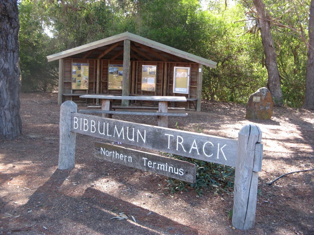
Shortly after leaving the northern terminus the Track enters Kalamunda National Park and crosses Piesse Brook to skirt the rim of the Helena Valley, passing through slopes of jarrah, marri, wandoo and the unusual butter gum. Piesse Brook is named after William Roper Piesse, a prominent citizen in the area in the mid eighteen hundreds. Soils here are shallow but host a myriad of colourful flowers in spring.
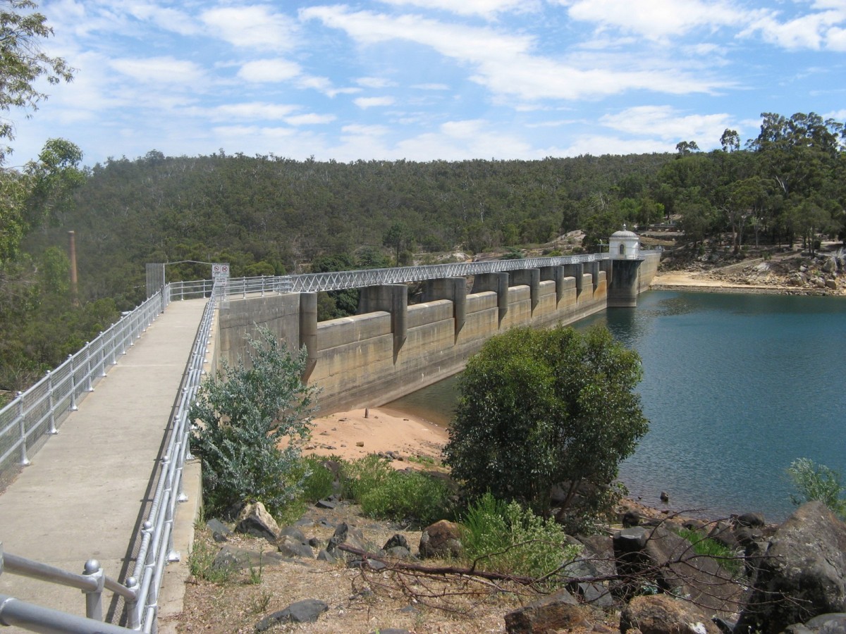
The Track crosses the wall of Mundaring Weir close to the historic Mundaring Weir hotel, and passes through the Perth Hills National Parks Centre.
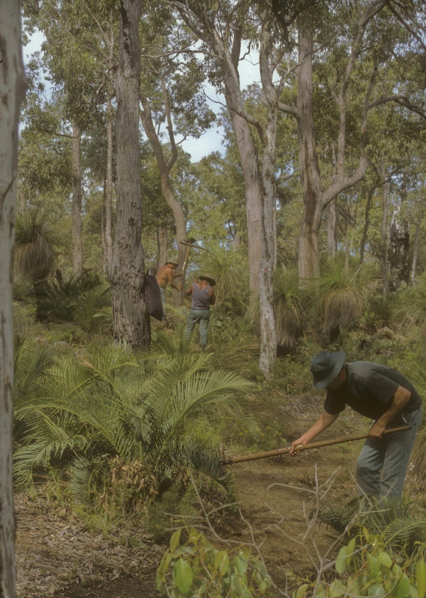
The trail south from Waalegh (pronounced ‘walich’) campsite to Ruen Road was the first section to be hand-built by prisoners. This initial joint venture between the then Department of Conservation and Land Management and the Ministry of Justice was such a resounding success that similar ventures were subsequently used along the length of the Track. This section was subject to a severe bushfire in January 2005, which caused the destruction of the Beraking campsite. The shelter and facilities were rebuilt within the same year.
Beyond Mount Dale, named after Ensign Robert Dale who in 1830 led a reconnaissance party from the Swan Colony in search of fertile land, lies the Brookton campsite. The Track from Brookton Highway to the campsite (2.5km), and the facilities at the campsite itself, are designed to be accessible for people with impaired mobility. It uses designer principles that provide access for all, and this section is ideal for older walkers and young families. Brookton takes its name from John Seabrook, the first European settler in the area.
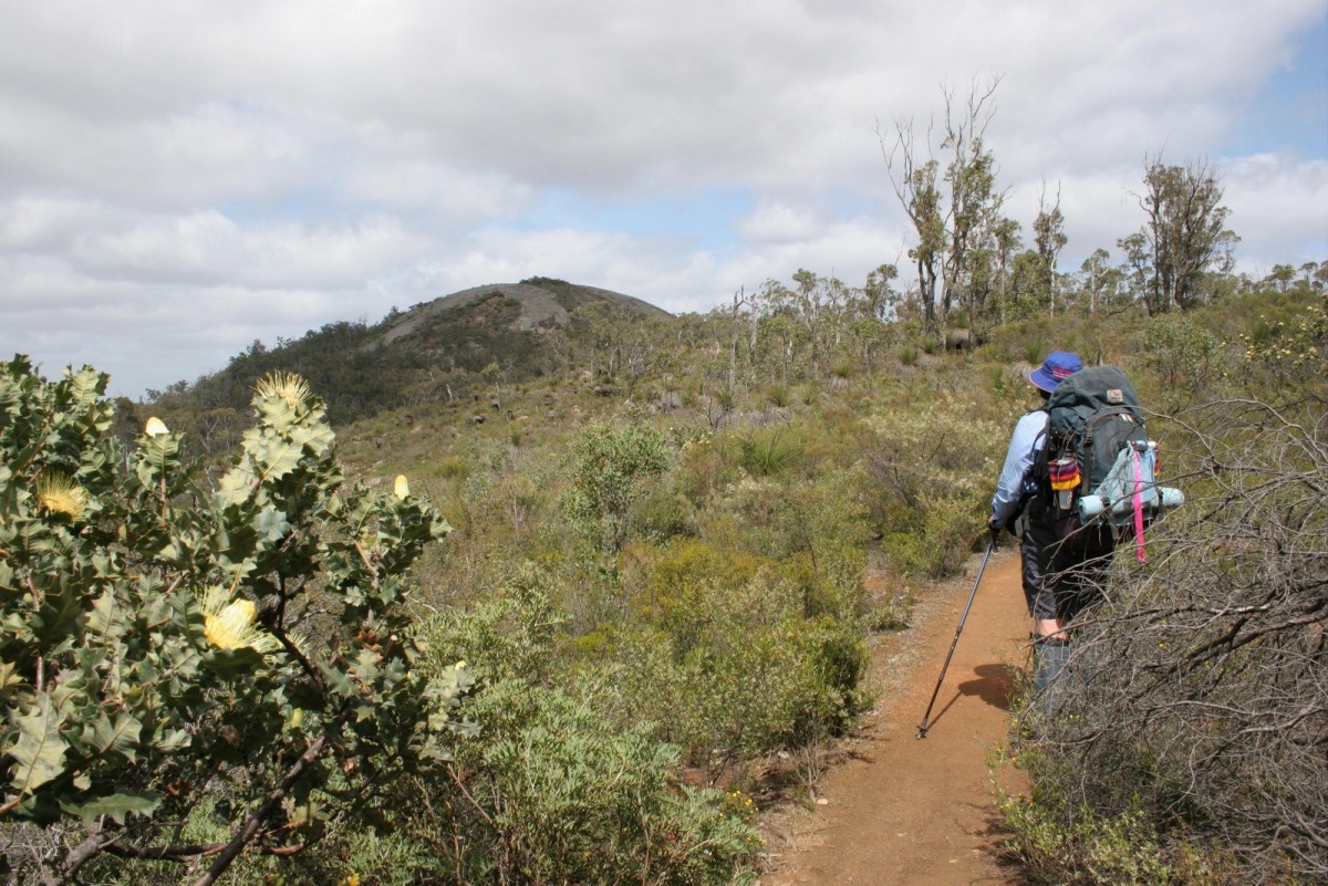
After crossing the highway, the Track crosses Abyssinia Rock, before entering the Monadnocks Conservation Park. Notable features of the Park are Mt Cuthbert, Mt Vincent and Mt Cooke, all of which provide outstanding views.
Due to the popularity of the Monadnocks and the Mt Cooke campsites, two group campsites have been built to prevent overcrowding. The Alyi-wa Miya Group Campsite is south of the Monadnocks campsite with a dedicated spur trail east of the Track. The Mt Cooke Group Campsite is around 500 metres north of the original Mt Cooke campsite (between Sullivan Rock and the original campsite) and is visible from the Track.
Mt Cooke, at 582 metres, is the highest point in the Darling Range. Mt Cooke is named after Ernest William Cooke, the first Government Astronomer of Western Australia. South of the Canning campsite the Track passes over the Canning River. The relatively rare Darling Range ghost gum or butter gum can be found on the west facing slopes of Mt Cuthbert and Mt Cooke.
South of Mt Cooke, the trail parallels the Albany Highway, and passes through extensive flats of pale barked wandoo, before crossing the highway close to the North Bannister service station. This is located 85km south-east of Perth, and is accessible from the Track via a spur trail. It provides southbound walkers with their first opportunity to get some basic refreshments since leaving the Mundaring Weir.
Seven kilometres south of the Albany Highway crossing, the giant granite mound of Boonerring Hill rises above the jarrah forest, providing, a visual panoramic reward for the short, strenuous climb to the top. In spring its fringes are clothed in a dazzling display of pink and gold feather flowers. Further along, the low peaks of the weathered granite of White Horse Hills offer more views.
The southwest of Western Australia is a highly diversified and complex mineralogical region boasting a wide selection of strategic and industrial minerals. Mining is one of WA’s major industries and it is evident in this section that the Bibbulmun Track provides a narrow green corridor for walkers and wildlife as bauxite and gold mining operations can be clearly seen on both sides of the White Horse Hills.
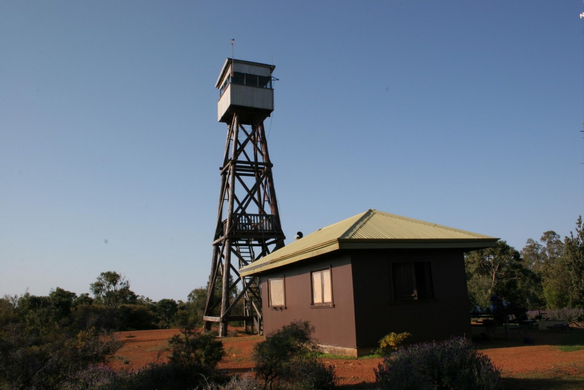
On the summit of Mt Wells, The old firewatcher's hut provides views from its fire tower. The hut itself, which is a replica of the original that was destroyed in bush fires of 1961, has been converted to a Bibbulmun Track shelter. Here, walkers can experience something of bygone times, when the firewatchers would spend months living in the hut, keeping a look out for bushfires. On the southern side of Mount Wells, walkers may hear the sounds from the Boddington Gold mine – now one of Australia’s largest open pit gold mines.
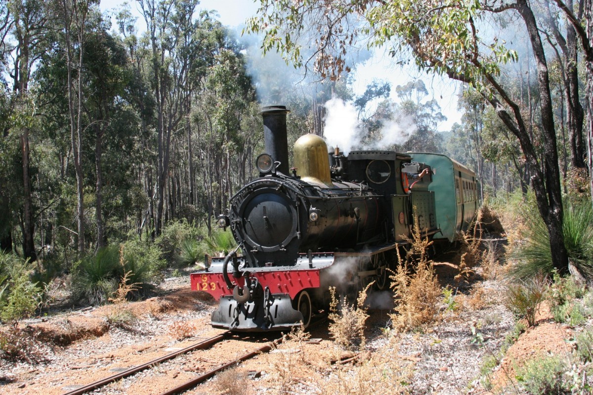
From Mt Wells the Track follows the old rail line for 15km through mixed jarrah/marri forest into Dwellingup. Most of the bush railways that served the old sawmills are gone, but a train still operates on the line from Dwellingup to Etmylin, giving visitors a taste of a bygone era.
For more information on walking from Kalamunda to Dwellingup go to the Section by Section Guide.