The Donnelly River is a companion for much of this section as the Track wends its way through the river valley. This translates into some very challenging walking on some parts. In fact it has some of the toughest hills on the Track in one area. It is balanced though with riverside campsites, restful swimming holes and some of the best old-growth karri forest in the south west. In late spring this section comes alive with colour and walkers will be amazed at the variety of flowering plants. The challenge of the hills is diminished a little by the easy walks along the old rail formations. Indeed there is much forest railway history along the Donnelly. How many old trestle bridges across the river can you spot along the way? Further south Carey Brook offers a great spot for lunch with its cascading waterfall - a precursor to the larger waterfall at Beedelup Falls. Walkers soon reach Pemberton but not before traversing the crystal clear waters and bird life at Big Brook Dam. Through walkers will need to carry food for five days on this section.
From ‘Twin Bridges’ south of the Village, the Track follows the Donnelly River. Tom Road is the only campsite retained from the original 1970's alignment of the Track and overlooks a permanent pool in the river amongst granite boulders and massive karri. It’s a lovely spot for a swim.
South of Tom Road, One Tree Bridge on Graphite Road is a very popular tourist spot. As the Donnelly River meanders towards the coast, the Bibbulmun Track wends its way through the river valley.
Heading south from Seven Day Road, walkers descend through mixed jarrah and marri forest before returning to karri. Marri has large woody fruits known as ‘honkey nuts’ made famous by May Gibbs' children’s story books about the ‘Gumnut Babies’. For more information, see www.maygibbs.com.au
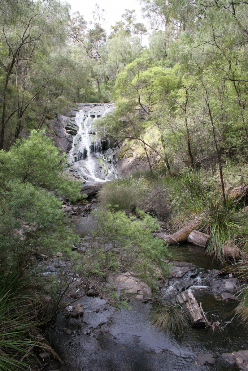
The Falls are the focal point of the park, framed in spring by blossoms of golden waterbush, starry white crowea and purple tree hovea. Beedelup National Park is named after Beedelup Brook, which has been shown on plans since 1875. It is likely to be derived from an aboriginal word ‘beedja’ meaning sleep, so ‘beedjalup’ would mean ‘place of rest’, which would be appropriate since Beedelup is a popular and peaceful recreation area.
North of Pemberton the Track passes the Big Brook Arboretum, a popular picnic and camping area featuring mature, exotic trees. Three mills were here in the early 1900’s and cut half a million railway sleepers for the new Transcontinental Line, which was completed in 1917, running between Port Augusta and Kalgoorlie, crossing the Nullarbor Plain.
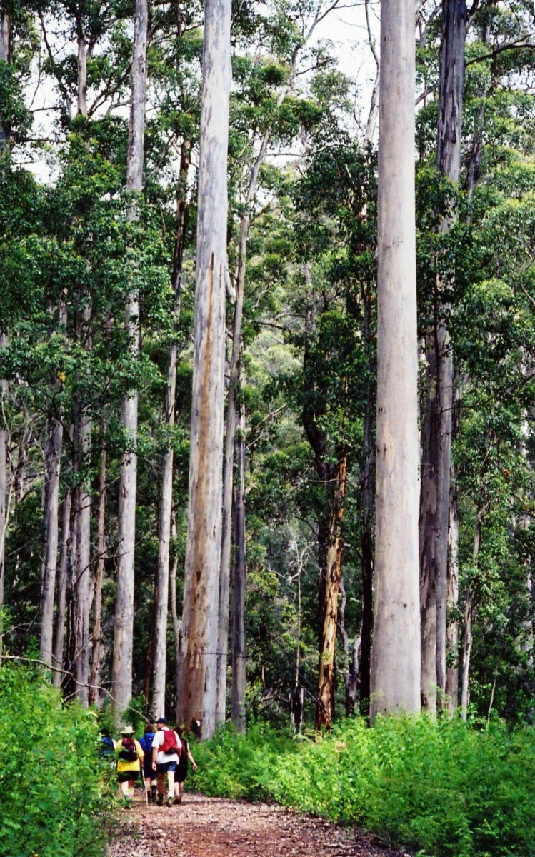
Settlers arrived in this area in the first half of the nineteenth century. The magnificent karri trees led to an early attempt to set up a timber industry, but transportation was too difficult and the project failed. The settlers turned to farming, producing fruit and vegetables and grazing cattle. In the late nineteenth and early twentieth centuries, new technology enabled the settlers to return to the concept of making an economic return from the huge trees, and three timber mills were set up.
For more information on walking from Donnelly River to Pemberton go to the Section by Section Guide.


