Jane Greenwood and John Faris, Perth, WA
The Milford Track is one of the Great Walks in New Zealand and the world, running from Lake Te Anau to Milford Sound in Fiordland in the southwest of the South Island. It follows the Clinton River from the head of the lake, crosses the McKinnon Pass and then descends down the Arthur River to Milford Sound 53.5km later. It passes near the Sutherland Falls which are 580m high and the fifth highest in the world.
We booked the Milford Track hike in July 2004, as soon as bookings opened. The Department of Conservation (DOC) allow only forty non-guided walkers a day and the walk is always booked solid between October and March. Because of the changeable weather, and to conserve the environment, hikers must stay in the DOC huts, tents are not allowed.
So after many months of planning, we finally left Perth, flew into Queenstown on December 15, collected a hire car and drove to Te Anau where we stayed the night at the YHA.
DAY 1 (5km)
There is a short drive further up the lake to Te Anau Down where we caught the 10.30am ferry (about 50 mins) to the mouth of the Clinton River and the start of the Milford Track. The boat had a mixed load of travellers - guided day walkers, guided four-day hikers and the rest freedom/independent hikers (us!!) Only a short walk to Clinton Hut. The weather looked awful - grey sky and low cloud- but as the day progressed the weather got better and better and by mid afternoon we had blue sky, sunshine and heat. After lunch we walked down to the Clinton River, which we had followed all the way to the hut, a fabulous spot.
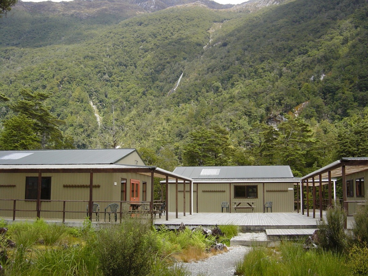
The Clinton Hut is nestled in a valley surrounded by huge mountains and a waterfall. The site has two bunk rooms with twenty bunks in each plus a separate kitchen/dining room with a wood heater plus twelve gas burners. We had brought our own stoves as we didn't know how many burners would be provided. There were sinks with cold running water and two flush loos with hand basins. All a novelty, as we only had the Bibbulmun Track shelters as a comparison. Mattresses are supplied on the bunks, which made quite a difference to the weight of our packs without our Thermarests.
DAY 2 (16.5km)
We had a wonderful sleep. Despite there being twenty hikers in our bunkroom, there were no snorers, although we found out the other bunkroom had two or three very loud ones! Set off at 7.45am but not a good day. Looked as if the drizzle would clear but the rain became very heavy. The scenery continued to be stunning—waterfalls, cascades and huge mountains. The walk was very easy apart from the last two to three kilometres. The track is surrounded by snow capped mountains and wanders through a valley and canyon.
The Mintaro Hut is at the head of the Clinton Valley next to Lake Mintaro. The hut has a large kitchen/dining area with two bunk houses which sleep eight people in each (we were in one) and a huge dormitory over the whole area which sleeps twenty four. There was a pot belly stove in the dining area which had a huge area to heat, but it was not too effective. The bedrooms were freezing, we were only just warm enough in our WA hiking gear!
At 7.30 each evening the hut warden gives a talk on what to do and not to do in the huts and gives a run down on what to expect on the hike the following day. We were told that snow was forecast.
DAY 3 (14km plus 5km return to the Sutherland Falls)
Another peaceful night but the weather next morning was foul. The hut warden had warned us that the track may have to be closed and we weren’t allowed to head off before 7.30am, when she received the weather report.
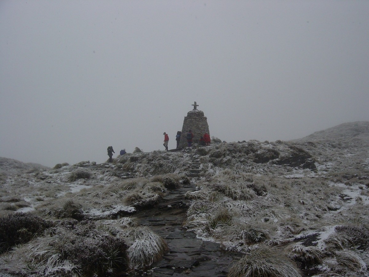
This should have been the most exciting day of the walk as we ascended from Mintaro Hut at 600m to MacKinnon Pass at about 1,070m and then up to the highest point on the track at 1,154m. It took about two hours to reach the top of MacKinnon Pass, which has a memorial to Quintin MacKinnon, one of the early explorers in the area and the person who discovered the pass. Half way up the mountain we ran into snow, and we were freezing by the time we reached the top. We kept warm while moving up but once we reached the top there was a gale force wind blowing and we got cold very quickly.
About thirty minutes after the pass there is a hut for hikers to rest and warm up again. The hut has a gas burner, kettle and water. A loo is also provided, with a superb view in good weather. It is known as the loo with a view, but the window was iced over and the blizzard was still playing havoc with the visibility!
We couldn't help wondering when we were on the top of the mountain if we should really have been there. However, once descending we were completely out of the wind. The views from the top should have been brilliant but the cloud was so low and the snow so heavy that visibility was often less than 100m. John said before the hike that he didn't care what the weather was like for the hike as long as day three was good. The hike was quite strenuous because it was almost all rocks on the descent and very slippery in places.
Near the end of the hike we dumped our packs at Quintin Hut, another rest stop, and walked about 2.5km to the Sutherland Falls. The walk up was quite steep and slippery. Absolutely beautiful in spite of the weather, the snow having now become rain. John very bravely walked behind the falls. By the time we reached Dumpling Hut at 7.00pm we were shattered! The forecast for the next day was for rain.

DAY 4 (18 kms)
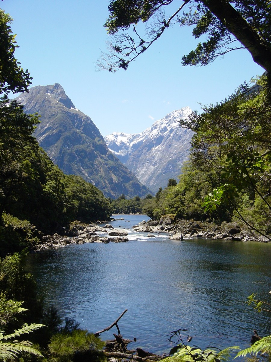
Sheer joy—blue skies and sunshine. None of us could quite believe it and didn't trust it to last, but last it did and it was the best day on the track. We had thought day four would be very ordinary for some reason but it was wonderful. One fabulous waterfall after another; lovely beech forest and glades all the way and the ever present mountains looming overhead, looking their very best with snow capped tops against a blue background. Took far too many photos of waterfalls! We were feeling a bit weary after the epic journey crossing the pass the day before, we had to be at Sandfly Point by 2.00pm to catch the boat over to Milford Sound. We had to walk at a fairly brisk pace to make it and wished we had woken at 5.30am so we could have spent longer enjoying the sights. The forests, lakes, rapids and waterfalls are all terrific and then you realise the mountains are still there overlooking everything else.
Once we arrived at Milford Sound we went on a one-and-a-half-hour boat cruise. More mountains and waterfalls but this time viewed from the water. We then caught a bus back to Te Anau Downs YHA where we had left the hire car, a two hour trip through beautiful countryside, seeing another view of the many mountains. Felt quite weary but had had an excellent four-day adventure and met some really great people.