Katie Stevens, Perth, WA
In 2018, my partner and I ended a wonderful chapter of our lives living in Melbourne and moved back to Perth to get married. The planning of this relocation, wedding and resignation led us to the realization that this may be the perfect and possibly only time that we would have the opportunity to tackle a long-distance thru-hike. Considering my husband proposed to me on a bright green mossy carpet in Pine Valley on the Overland Track in Tasmania, we thought it a poetic start to a new chapter in our lives.
After six months of intensive planning, research, scheduling, and replacing gear, our two mates, my husband and I were suddenly touching down in Tuscon, Arizona. Here we would spend two days completing our first resupply, before making the very long journey by Greyhound to Lordsberg, New Mexico. The next morning we met our driver at 6am along with a handful of other hikers. The air was cool, but we knew the heat would rise rapidly as soon as the sun showed itself. Jeff (our driver) bravely tackled the four or five hour grueling 4wd track in his seasoned Ford Scout all the way through the Hatchet Wilderness to Crazy Cook Monument on the border of New Mexico and Mexico. This marks the southern terminus of the Continental Divide Trail. The general level of tension and apprehension in the group was already high, and rendered most of us into a state of nervous banter. This was only worsened by Jeff, who after removing us and our gear from his vehicle at midday in the oppressive heat, pointed north and said “Walk to survive”, before taking off in a cloud of dust. I’ll bet he laughed to himself all the way back to Lordsberg.
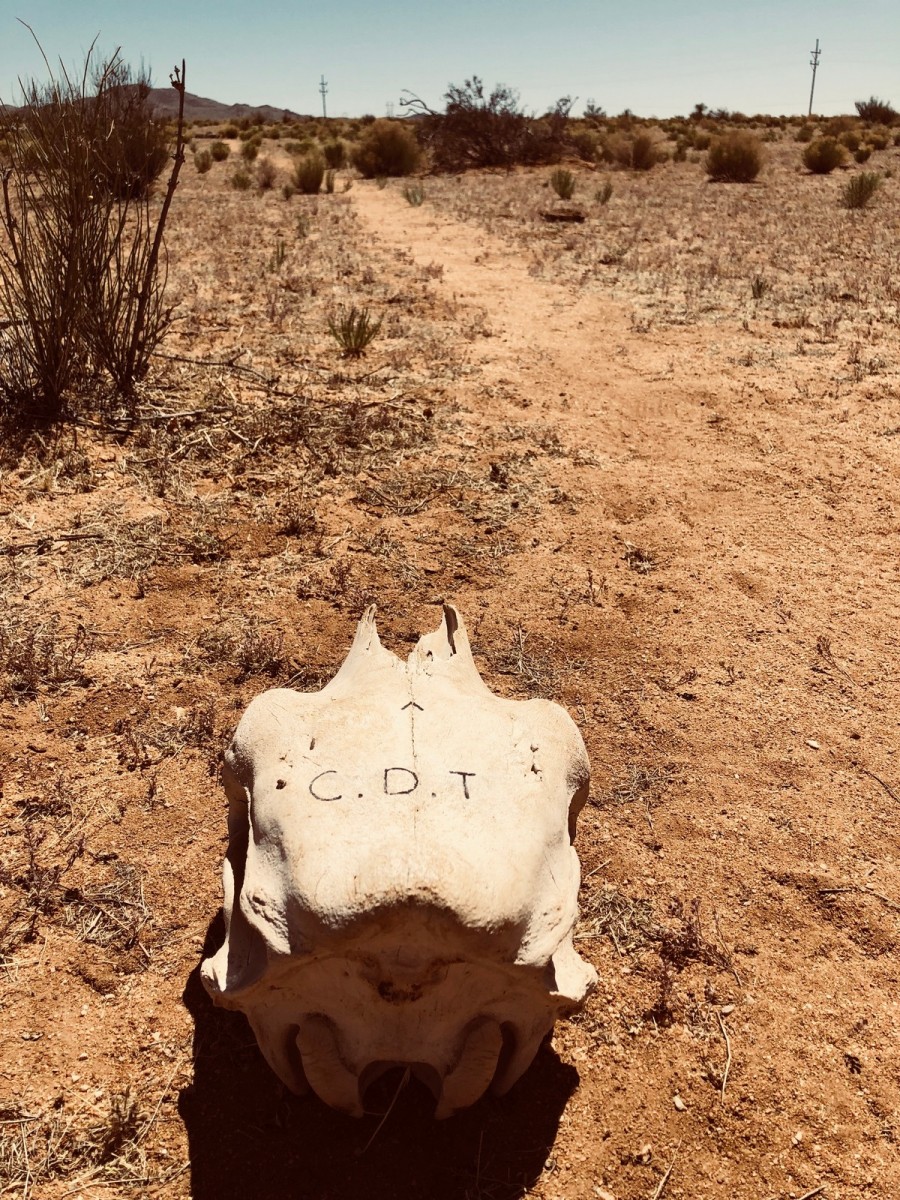
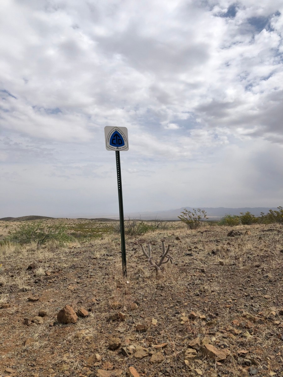
The Continental Divide Trail (CDT) runs over 5,000km across five states of the USA. Starting from the South it travels through New Mexico, Colorado, Wyoming, a tiny bit of Idaho, then Montana, with the finish line just across the border into Alberta, Canada. The trail loosely follows the Continental Divide of the Americas, hence its name, and along with the Appalachian and Pacific Crest Trails, collectively known as the Triple Crown Trails.
There are a few ways to tackle the CDT; Northbound or NOBO, Southbound or SOBO, and Flip-Flop which consists of completing the trail by flip-flopping to different sections. Finally, for those who really like to avoid real life you can Yo-Yo,, which means that after completing the track, you simply turn around and do it all again in the opposite direction (crazy, I know). My husband and I being the sensible pair that we are decided to join the masses and take the popular and traditional journey Northbound. When I say masses, we were four of approximately 300 hikers to attempt the CDT last year, and these 300 hikers tend to spread out over the months of March, April and May for their start date. Suffice it to say you should be prepared to be alone a lot on the CDT.
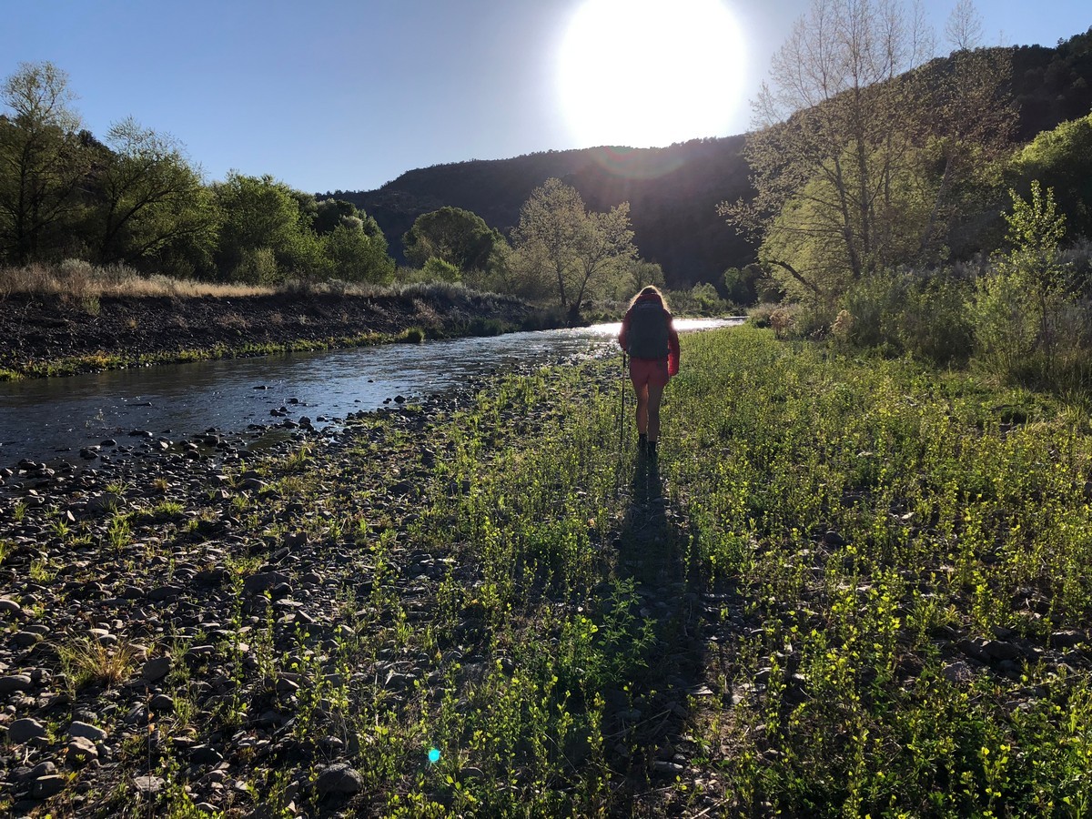
The first section of New Mexico is called The Bootheel, or as I like to call it The Surface of the Sun. Water is managed by trail angels and CDT volunteers for the first two weeks, in the form of stocked caches dotted along the trail, (and maybe an icy cold Gatorade and pack of chips if you’re lucky) then after that you’re on your own. The heat was relentless and the severe lack of shelter made it near impossible to find any relief from the sun. There were many sarcastic references at this point as to why we had chosen to do this for our honeymoon; there were many tears (and tantrums—mostly aimed skyward at that searing ball of fire) and a lot of pain from aching hips and calves, to sunburn, to toes that no longer resembled toes. However, if the desert was a test, we passed—not with distinction but we made it through. The saving grace of New Mexico is the incredible diversity that somehow manages to cling to life in the desert, and the promise of fresh water in the Gila River Valley. This oasis of trees and, more importantly, reliable free flowing water, is something to behold. Sheer cliffs surround you on either side as you follow the river for four glorious days, it is truly a welcome relief from the heat and harshness of the desert.
As many of you may understand, when completing a long distance hike in a remote area, soap can have the wonderful effect of giving you a momentary sensation of cleanliness and normality. When you’re on the trail for weeks on end, or months, this need for such a sensation tends to become stronger and stronger as you begin to cherish those tiny moments when the dust has been cleaned off your legs, or the crystalized sweat is no longer prickling on your skin, even for a little while.
With this in mind, I leave you with a short story about a tragic loss. This excerpt is from our CDT Blog, written by my husband.
Sam and Kate Hike: CDT Chapter 2 – Cold Feet
It was the end of a very long day. Our camp was within sight, a few short strides up the sandy river embankment. I simply had to cross the relatively shallow, albeit rocky flow of the Gila River again before I could return to the warm embrace of our smoky campfire. But alas I was tired and my feet, lazy.
Upon exiting the river my left foot failed to find safe purchase and lurched ominously sideways, the USD $1.00 thongs I had purchased from the Family Dollar store in Lordsburg a week prior failing to provide even a smear of frictional resistance against the pebble slick river underlay.
Having just finished bathing myself in a shallow turnabout I was wearing only my underwear, carrying the remainder of my clothes, shoes and our eco-friendly, biodegradable soap under my arms.
As my foot denuded itself of the micron-thick, questionably manufactured protective varnish of the thong the middle meat of my already battered foot struck an upright rock with enough force to expel from my lips a guttural sound somewhere between a bloodcurdling death gurgle and a heavily pregnant warthog birthing a sizeable litter. Though apparently not loud enough that Josh, who was fishing some 15 meters upstream, nor the girls, who were tending the fire, registered the noise.
I fell to my knees in the river and glanced sideways to witness the maiden voyage of the H.M.A.S Camp Soap as it plunged bow first into the froth of the river, expertly navigating every set of rapids and obstacles as it sailed out of sight and into oblivion, taking with it our last vestige of small human comforts for the next week or more.
- Sam Gabell
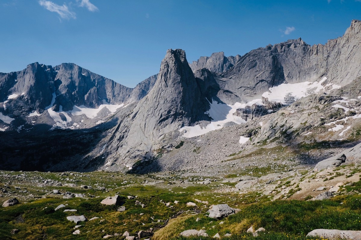
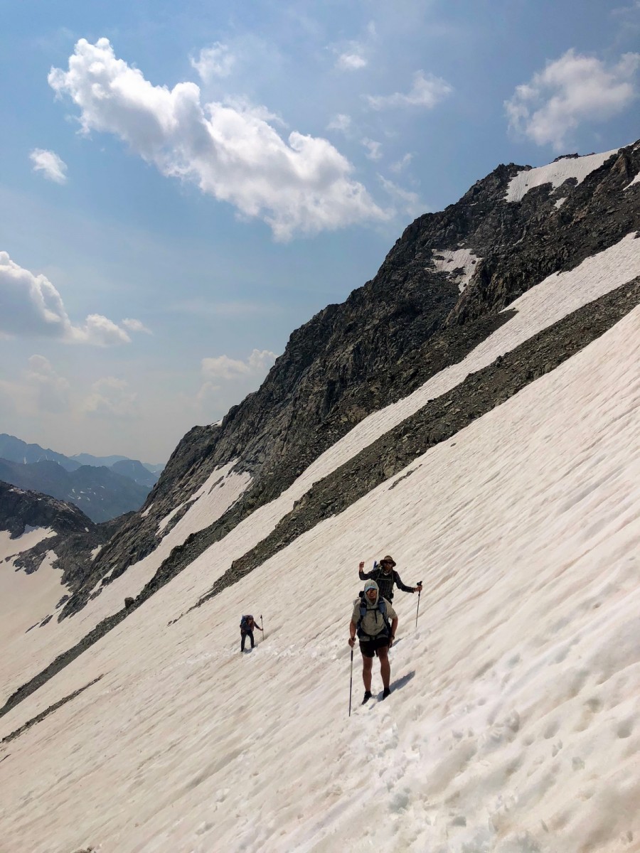
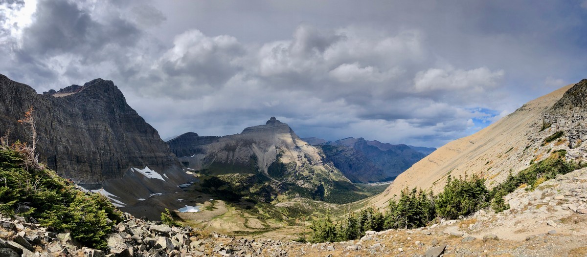
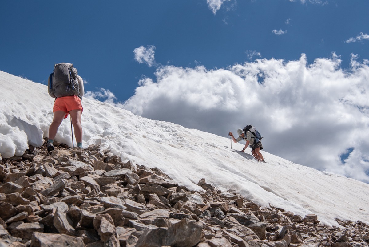
The CDT is obviously far more than just New Mexico, and each section is a story on its own. The San Juans, for example, in Colorado are one of the most talked about sections of the trail, and for good reason. They’re loaded with majestic but daunting mountain peaks and they’re completely wild and alarmingly remote. They’re also very dangerous and very challenging and we have many a story of the literal and metaphorical ups and downs of tackling that section. There are so many sections of the CDT that provided significant challenges, frustrations, enlightenment, and jaw-dropping scenery; a single article could not even begin to describe them all. We both look back on the good, the bad and the ugly (yes it got ugly at times), with a sense of pride and achievement and feel genuinely lucky to have been able to have witnessed some of those beautiful sections of wilderness in the world.


Fact File
When to go: If NOBO – mid-March – mid-May.
- You do not want to be in the Bootheel when summer really hits, but you cannot hit the San Juans in Colorado too early or the snow will be too deep. You also need to get to Glacier National Park in Montana before winter sets in or you won’t get through the passes
- Timing and planning is key!
What to wear: Be ready for 4 seasons. Examples:
- You’ll need to be organizing gear in advance to be held for upcoming sections (Ie: Ice Axes and Crampons to be delivered to Chama, NM. for upcoming South San Juan Mountains in Colorado)
- May need extra clothing for Montana, that you won’t need for New Mexico
- Timing and planning again!
Equipment: NOTE: Don’t sacrifice all comfort for weight, however - if you have too much weight you probably won’t finish – find a balance that works for you. I have only listed a handful items here, there are more obviously that goes without saying.
- Sleeping bag (-10°C)
- Pack, around the 40L mark
- Hardy, warm, breathable and well-made hiking clothing that can do the distance
- Trail runners – avoid Gore-Tex*, go wide, budget for 4 pairs for entire trail
- Bear Sack - not required until Wyoming (that sentence could be argued with). We didn’t carry a bear sack until Wyoming… there are however bears in New Mexico
- Our full personal gear spreadsheet here
- Great breakdown of most popular items on trail here
- Bounce Box (definition here from Halfway Anywhere)
Guidebooks and Maps:
- For those deadset on paper maps and guides (would not rely solely on these, personally prefer digital)
- CDT Planning Guide
- CDT Data Maps (free printable downloads available)
- Bear Creek Survey Maps
- Yogi’s Handbook
- Yogi’s Laminated Resupply List Kit
- Digital maps, and navigation apps
- Atlas Guides (Guthook)
- Avenza – Jonathan Ley (detailed alternate maps incl. whole CDT) free download
- Avenza – CDT Coalition (free download)
Food:
- Great explanation and breakdown of resupplying here. Again, planning is key.
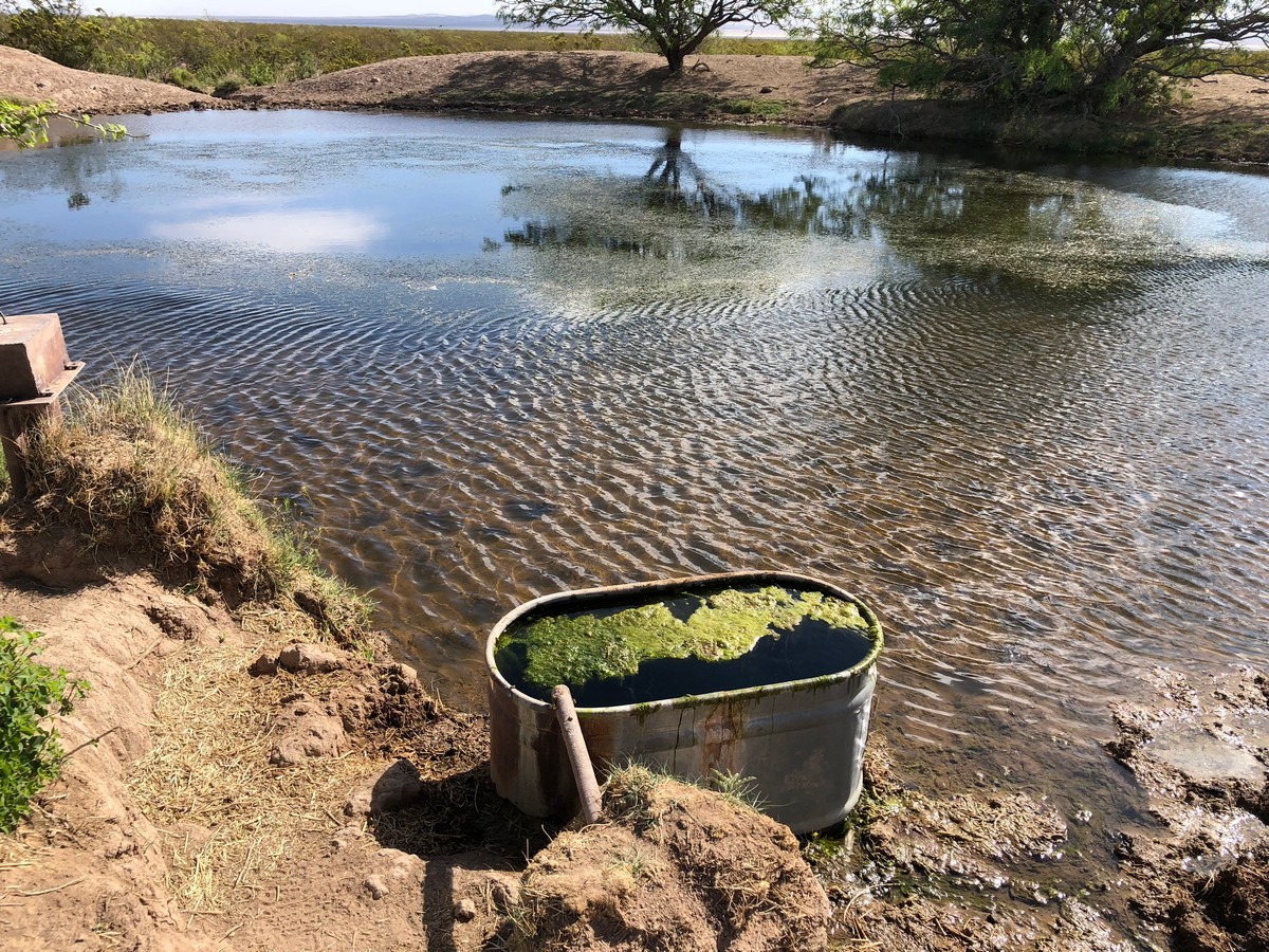
Water:
- Get a decent filter, know that cow poop and algae blooms will be what you’re filtering through. Enjoy those fresh snowmelt streams in the mountains, and thank the gods for CDT's trail angels.
How to get there:
- NOBO: Fly to Tuscon, Arizona (closest city to Southern Terminus) > Greyhound Bus to Lordsberg, New Mexico > Shuttle from Lordsberg to Southern Terminus, tickets here.
Permits:
- Indian Peaks Wilderness (only required if you stay overnight)
- Rocky Mountain National Park (must obtain permit before entering park)
- Yellowstone National Park (must obtain permit before entering park)
- Glacier National Park (lottery system for backcountry permits– don’t panic, they reserve sites for CDT hikers)
*There are some weeks on the CDT where you’ll be doing more than 5 river crossings a day, in the Gila River Valley, it’s about 10 a day. You must have shoes that have the ability to dry out – Gore-Tex will not do this, so you’ll have to take them off each time… think of all that time wasted tending to your feet!?
The Continental Divide Trail Coalition: https://continentaldividetrail.org/