Adrian Cazalet, Perth, WA
The Lebanon Mountain Trail (LMT) is a trail in its infancy. The LMT winds up, or down, the spine of Lebanon in the Mount Lebanon range for some 440 km. It was conceived in 2004/5 and the Lebanon Mountain Trail Association (LMTA) was formed in the same year, with its major objective being to “maintain, protect and develop the LMT”. The LMTA were advised by the Appalachian Trail Conservancy during the early development of the Trail. (Ed note: The Appalachian Trail Conservancy is a volunteer-based organization dedicated to the preservation and management of the Appalachian National Scenic Trail in the USA).
The concept of the Trail is different from many other hiking trails in the world in that it specifically aims to join up the communities through which it passes, and to provide out-door recreation and interesting opportunities for Trail visitors. The Trail represents a powerful effort to promote peaceful coexistence between the residents of the area and walkers through the promotion of responsible eco-tourism. There are no huts or shelters; instead hikers are encouraged to engage local guides and to use guesthouses and the village amenities on or close to their route. This in turn brings business to the local communities.
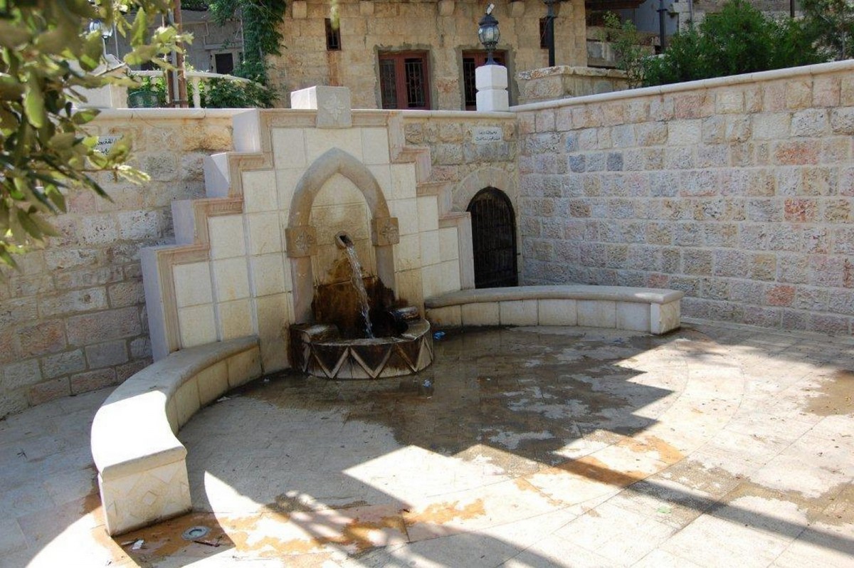
Lebanon is not a large country, only 200km from north to south and averaging 50km wide. The LMT runs from Qbaiyat in the north to Marjaayoun in the south, and is certainly not a stroll in the park or a walk through the bush. Of necessity the track has to negotiate steep mountains and river valleys, giving spectacular views, often out to the distant Mediterranean. It passes through or close to 75 villages, in some of which the LMTA has helped local people to set up accommodation. In others small hotels are available. Some villages and small towns have been encouraged and helped in refurbishing their historic central squares.
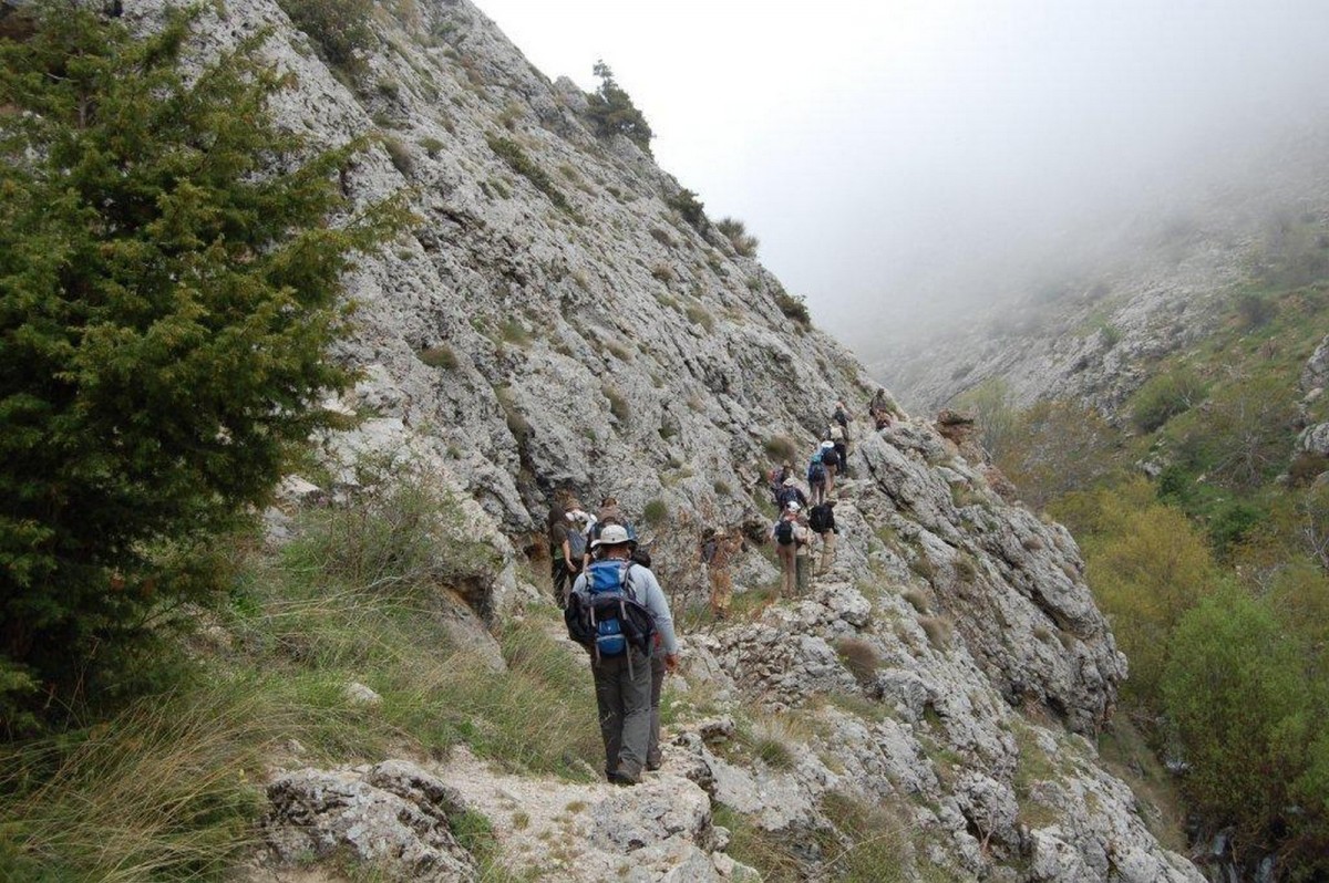
I was lucky enough to be able to join the Through-Walk 2010, an organised group walk with a small core of people walking the whole of the Trail and being joined at different stages by others for a few days or more. On Saturdays and Sundays, weekenders increased the numbers. A very efficient bus service transported the heavier gear from stop to stop each day, and visited Beirut regularly to transfer those joining or leaving.
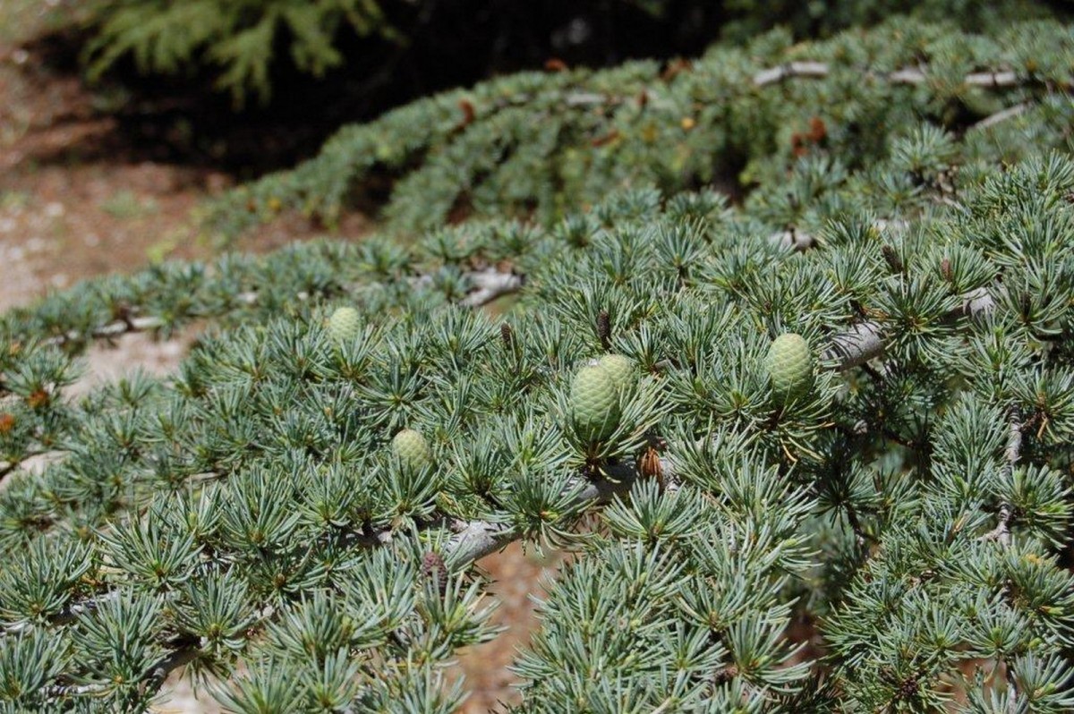
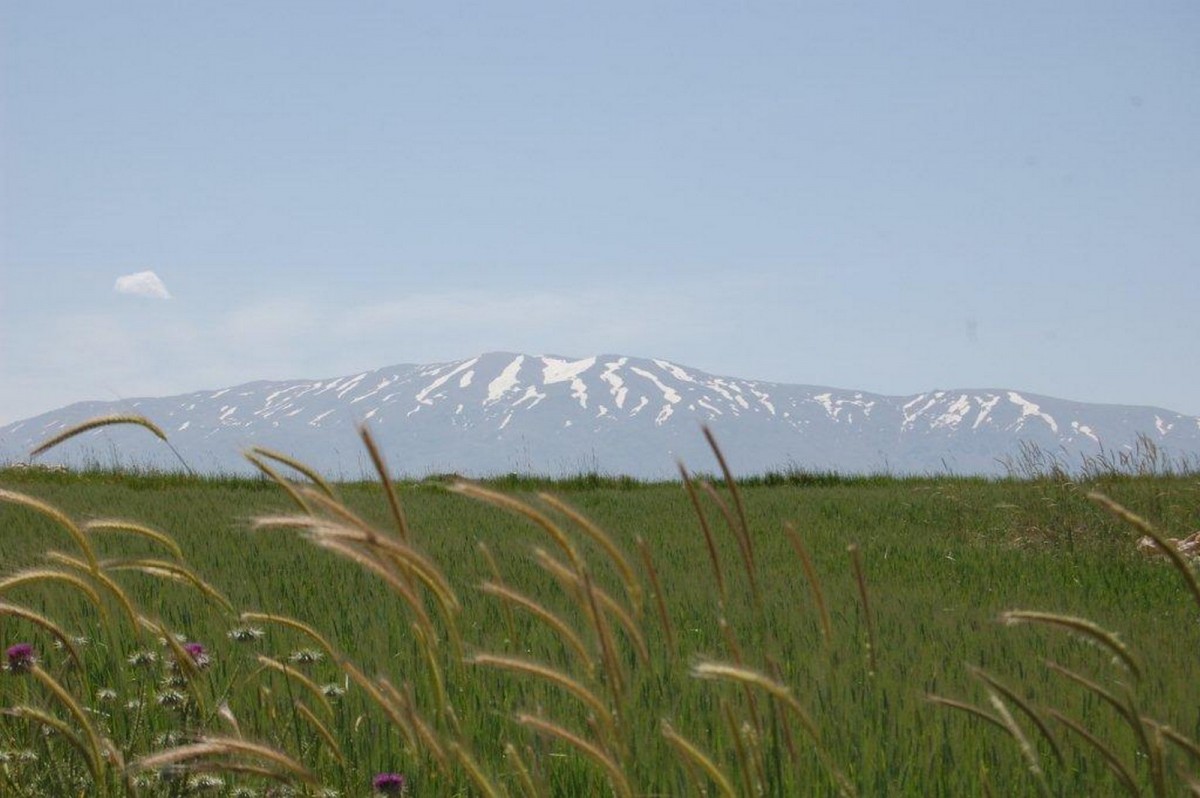
The Trail goes through a variety of landscapes. Predominant in the more northern area are orchards—apples, pears, cherries, almonds, apricots, and walnuts. Further south the Trail passes through several Cedar Nature Reserves where thousands of the ancient cedars are being replanted. These are the trees that the Pharaohs used in their palaces and tombs and with which Solomon built his great temple in Jerusalem. At frequent intervals springs of clear cold water gush straight out of the mountain sides, and in early spring there may be snow lying in the higher reaches. Wild flowers carpet the hillsides. Towards the southern end, where the Trail crosses to the Bekaa Valley, fields of corn and vineyards with olive and fig trees offer a mosaic patchwork of farming activity in the rich earth.
The Trail is divided into 26 stages, most being a day’s walk, with diversions of interest both on and off the path. These may be deep caves, old churches, Roman ruins, monasteries, or a cave fortress. At Baskinta, about half way along, the LMT joins with the Baskinta Literary Trail, visiting homes and a mausoleum of well known local writers and poets, including Mikhail Naimy and Amin Maalouf. At Bcharre the trail passes by the resting place and museum of Kahlil Gibran (The Prophet). In Bcharre itself Australians may feel at home— visit the Kangaroo supermarket and you may be greeted by “Good on yer, mate!”
My walk started in early April, when I stayed in a monastery at Qbaiyat overnight before setting off, after paying a visit to the butterfly museum, of its kind one of the best in the world. The first day took us to Tashea, a small mountain village with a church at one end and a mosque at the other. In a way this was a microcosm of Lebanon, a country of cultural and religious diversity where 18 different sects are officially recognised. The welcome we had there also emphasised the centuries old tradition of hospitality. Often there were invitations to stop for coffee or to stay for the night.
While the first couple of days had been moderate walking with some steep climbs and descents, the start of the third day from Qemammine was an almost vertical climb said to be 500m in one km. And that was not the last, although none were quite so precipitous! Five days in and we encountered the first of the cedar forests at the Horsh Ehden Nature Reserve. From the ridge above Ehden was one of the best panoramic views—the sight of the route of the Trail for the next four days.
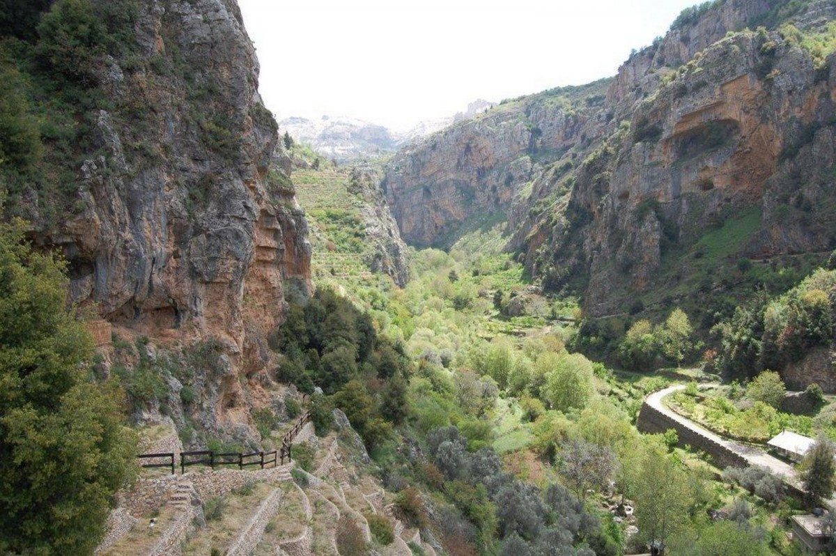
From there we descended into the Qadisha Valley, a World Heritage Site, home to many ancient convents and monasteries. Then up to Bcharre, across to the next 400 tree Cedar of the Lord Forest, on to Hasroun, and finally over a saddle to the Tannourine Cedar Reserve.
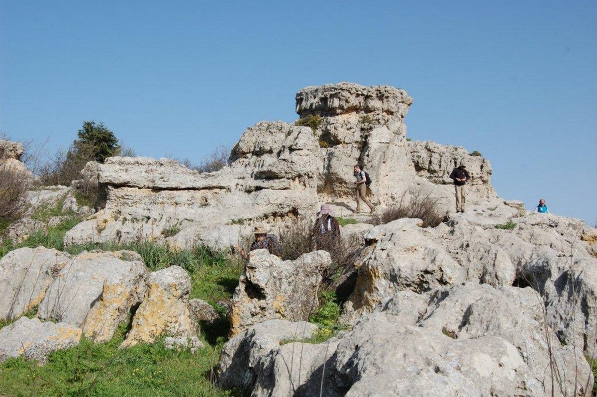
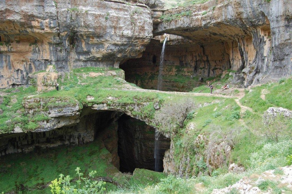
Each day there seemed to be some high point, sometimes man made, probably 2,000 years old or more, or often a natural phenomenon, of which the huge, seemingly bottomless sinkhole at Baatara was one. Just beyond half-way, at Mtain, the Through-Walk was the main attraction on a Saturday morning, at a celebration of the renovation of the historic town square. Around 800 people greeted us, speeches were made, and cameras clicked in a great festive atmosphere.
Near Falougha we visited the place where the first Lebanese Flag was raised in November 1943 to commemorate the newly-won independence. A short distance beyond, a crossing of the main Beirut to Damascus highway leads the Trail into the Shouf Mountains and the largest of the Cedar Nature Reserves. Here the Mount Lebanon range comes to its southern limit, but a climb on to the ridge above Barouk offers dramatic views to the Bekaa Valley in the east and westwards to the coast. From Jezzine, the town of waterfalls, the Trail turns east over the mountain to Aitanit, nestling above the Qaraoun Lake, the product of a man made dam across the Litani River.
As a demonstration of how much the establishment of a long distance trail means to the communities through which it passes, the walkers were given a great welcome at our final destination, Marjaayoun—more speeches, cameras and a buffet lunch.
To return to the beginning, this is a trail in its infancy but one with tremendous potential for the future. I feel greatly privileged to have walked the length of the LMT and I shall follow its future with deep interest.
For more information go to: Lebanon Mountain Trail.
To get a real flavour of the Trail visit: http://www.trekkinglebanon.com which includes a blog for the first half of the 2010 Through-Walk. (Follow the links to Thru-Walk 2010 or Older Entries).