Barry and Margaret Bryan, UK
Since we retired in 2000 Margaret and I have embarked on many adventures and have managed to celebrate our wedding anniversary on three occasions on the Bibbulmun Track; in 2003 at Dookanelly, in 2006 at Swamp Oak and in 2009 at Chadoora—all on end-to-end walks.
Travel is infectious and the more you travel, the more you want to travel. A few years ago I realised that there was a lot to see in the USA, so in 2011 I booked a small RV for eight weeks and off we went. We had a great time with good weather, fantastic scenery and some great hiking. The bug had bitten, so in 2012 we decided to go again and to do more hiking, staying out overnight. We were keen to backpack in the Yosemite National Park in California, Zion National Park in Utah and the Grand Canyon—where we intended to spend our wedding anniversary, hiking rim-to-rim. (Ed note: this means descending to the bottom of the Grand Canyon and climbing out on the opposite side, which involves descending from about 2500m to 750m and then climbing back up to 2200m. Makes Yarragil Form look like a scratch!).
I must admit to being somewhat anxious about backpacking in the USA and my principal concerns were black bears, electrical storms, flash flooding and to a lesser extent, route finding.
Our first three day/two night hike from Tuolumne Meadows in Yosemite was quite an experience. The weather was good, the scenery was magnificent and we saw no black bears. However, we did have a one hour electrical storm in our second camp, which was pretty scary as we were high up in the mountains and surrounded by some very big trees.
Our second trek, two days/one night, from Tuolumne Meadows and the third walk, the West Rim Trail in Zion, both went well and gave us much more confidence, but the problem at this point was that although I had been able to arrange permits for Yosemite and Zion I had not been able to do so for the Grand Canyon.
Good reviews on the internet led me to contact Wildland Trekking of Flagstaff, Arizona, who would provide transport from Flagstaff to the North Rim, a guide, rations, any kit that we didn’t have and transport back to Flagstaff at the end of our hike. We would be in a group of five so we would have company and most important, they would obtain the permits. I suggested a range of start dates that included our wedding anniversary, deposits were paid and there was a period of waiting. Then came the good news that our permit had been granted and that on our wedding anniversary we would be climbing out of the Grand Canyon up to the South Rim.
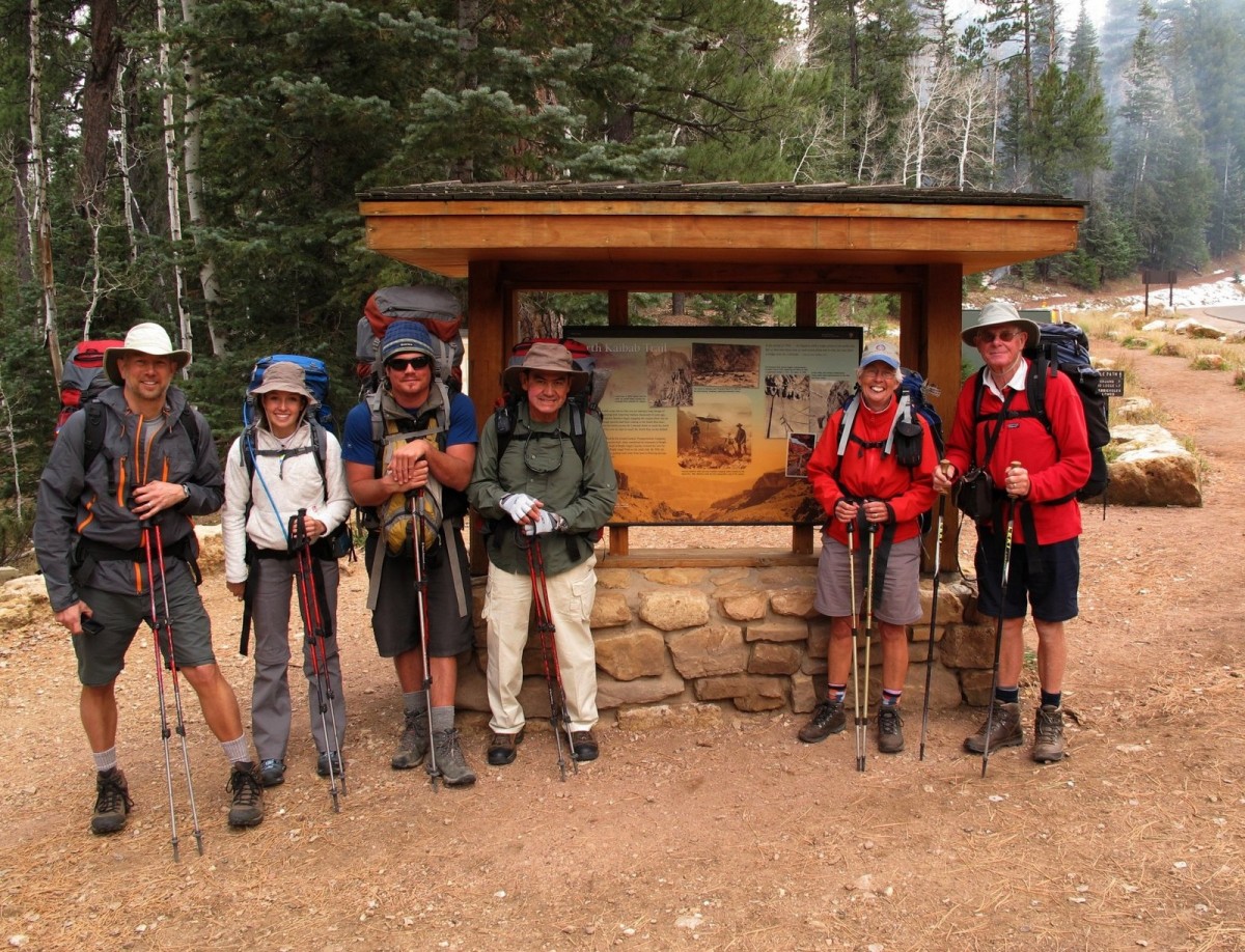
We headed down to Flagstaff for a night in a hotel before starting our hike. Early that evening, we met Russ, our guide, together with Luis, Maddie and John, who were to be our companions for the next four days. Russ gave us a full briefing on the trip including gear, provisions, the weather, and the nasty creatures that we might encounter. These included rattlesnakes, scorpions and spiders, but surprisingly the one most likely to cause injury was the local squirrel. Squirrel bites are the biggest problem at the South Rim because people try to feed, stroke or pet these attractive, harmless looking creatures.
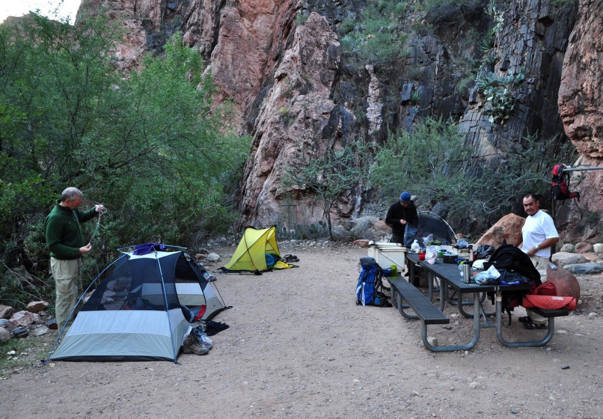
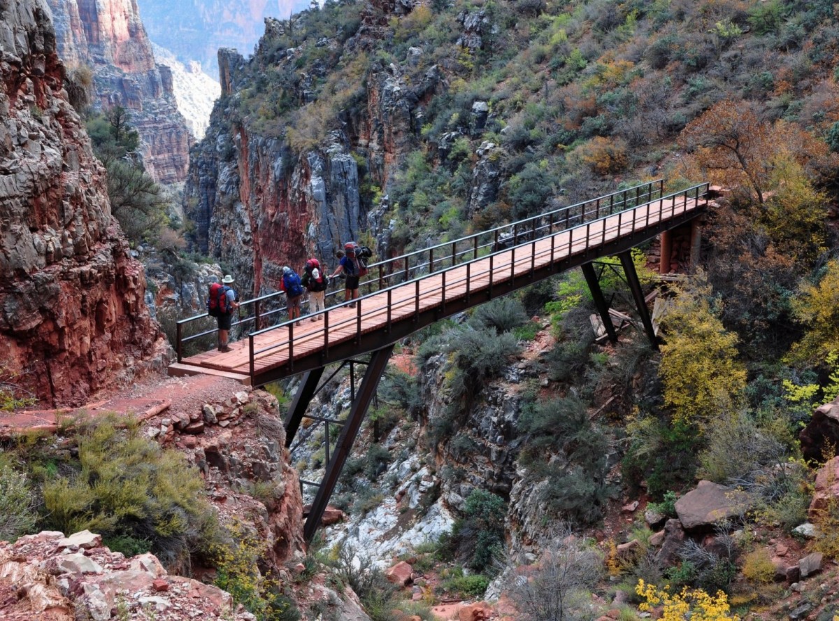
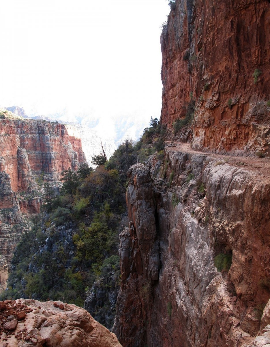
After a four and a half hour drive through heavy showers we unloaded our gear at the North Kaibab Trailhead on the north rim. Thankfully the weather improved and remained dry and bright for the duration of our hike. We organised ourselves, gathered in front of the trailhead notice board for a group photograph and headed off down the trail. After an hour we stopped for lunch, and then passed through the small, man-made Supai Tunnel and across the Red Wall Bridge. The views were spectacular, but the exposure at times was extreme—not a place for hikers without a head for heights! It was dark when we reached Cottonwood Campsite and after hot drinks and a good meal we settled down for the night.
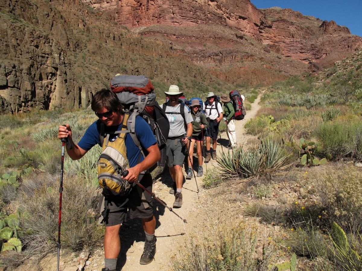
The following morning, the trail took us through desert vegetation, with prickly pear being the most common cactus. It became noticeably warmer as we hiked lower into the canyon, and trousers and fleece layers gave way to shorts and T-shirts. Russ produced another good lunch and we pressed on to reach Phantom Ranch mid-afternoon, close to the Colorado River. Phantom Ranch was very busy with hikers staying in the lodges, and on the campgrounds. There was also an endless procession of runners, attempting to run rim-to-rim-to-rim in 24 hours.
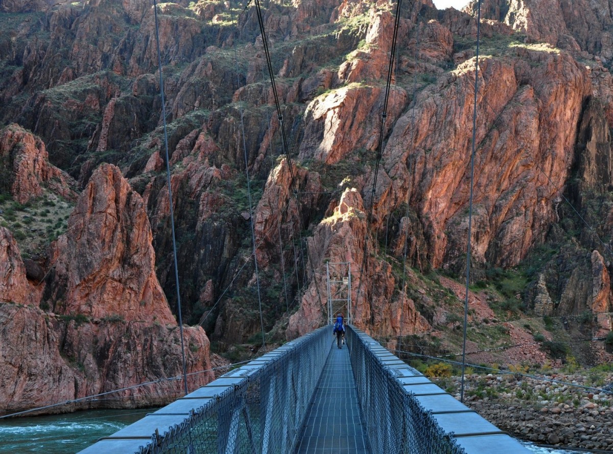
Before we left camp on our third day we walked the short distance to the Colorado River to see the Black, or Kaibab Bridge. This bridge was built in 1928, presenting the first opportunity for walkers to hike between the north and south rims. We, however, were crossing the river on the much newer (1960) Silver Bridge, so after collecting our packs we headed off along the river, crossed the bridge and followed the river for about a 1.5km before starting our climb uphill to the south rim—about 1600m above our heads.
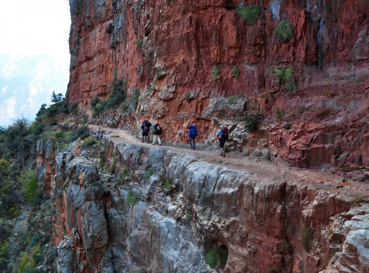
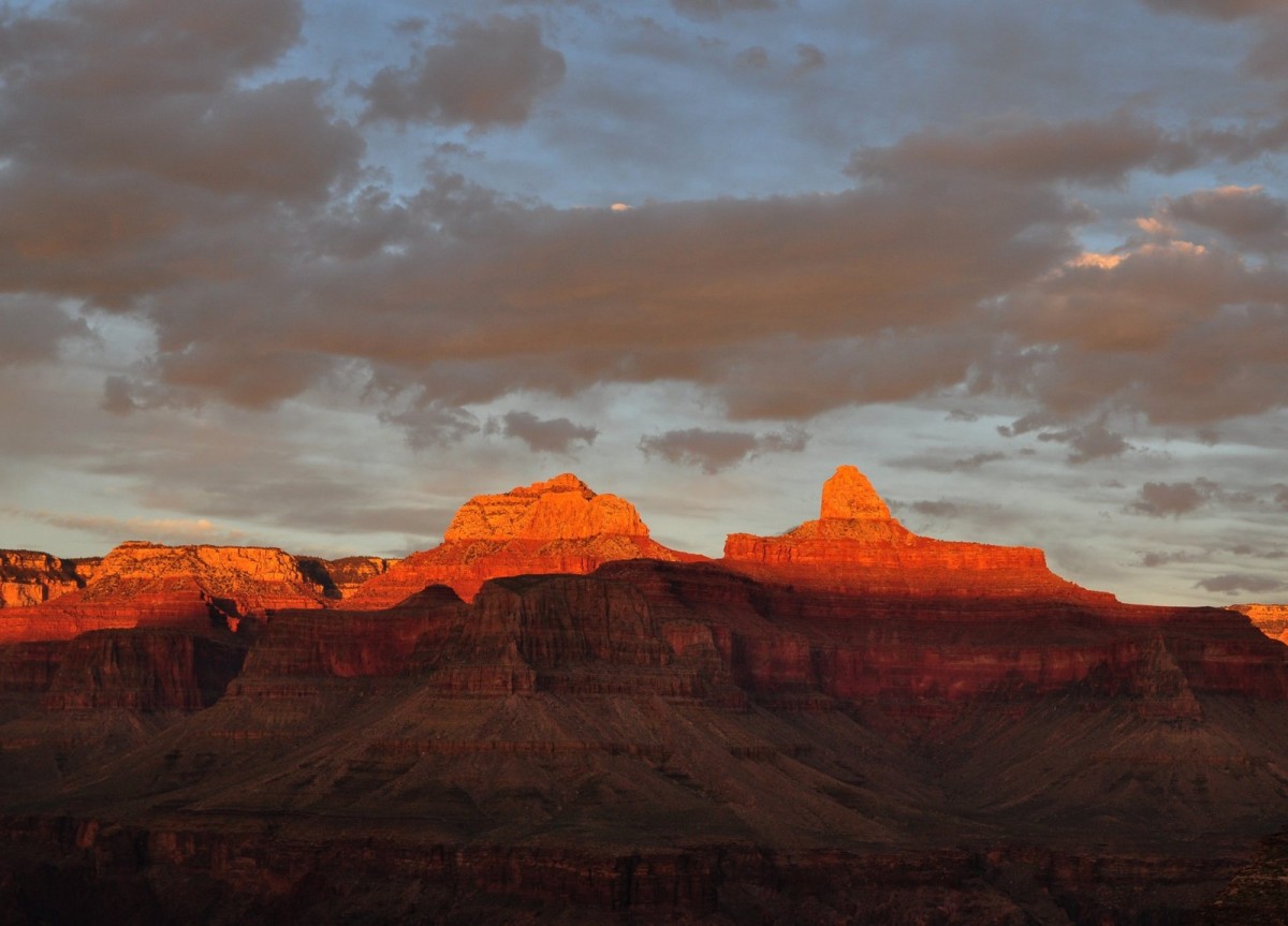
The climb was very steady along a well graded path and even the Devil’s Corkscrew—a short section of zigzags—was no problem. As we climbed we could see our destination on the South Rim, a rocky corner in the cliffs. Shortly after lunch we entered an area of lush vegetation with many cottonwood trees. This was Indian Garden, the site of our third camp, and we quickly settled down in the shade. After a short break we headed off to Plateau Point, from where the view of the canyon and the river was stunning, and it was interesting to see how the canyon was highlighted in the setting sun.
We broke camp early on the last day. Russ had estimated about four hours for the climb up to South Rim so we were on our way by 08.00, hoping to be on the rim by midday. Once again the climb was steady, with two lengthy sections of zigzags. It was about 7km from the campground to the rim, with two rest houses en route. As we climbed higher the views were magnificent, and we were able to look back across the whole route that we had taken from the North Rim.
And so, just before noon, Margaret and I linked arms to walk the last few metres onto the South Rim, celebrating our 46th wedding anniversary by completing our hike across the Grand Canyon.
The weather had been bright and calm but as we stepped over the rim the wind became very strong and gusty, the sign of a cold weather front heading in. After a coffee stop and a brief visit to the visitor centre we loaded our vehicle and ate a sandwich lunch as we drove back to Flagstaff. In no time at all we were back in our hotel saying fond farewells to Russ and our three companions. Then it was hot showers, afternoon tea and dinner with a few drinks to celebrate our achievement and our anniversary.
This hike isn’t difficult, although a reasonable level of fitness is necessary, it’s just the logistics that are the problem and we solved that by hiking with a company. Be aware though that the North Rim experiences snowfall from late October and access to it from the south may not be possible through the American winter.