Barry Bryan and Margaret Bryant, UK
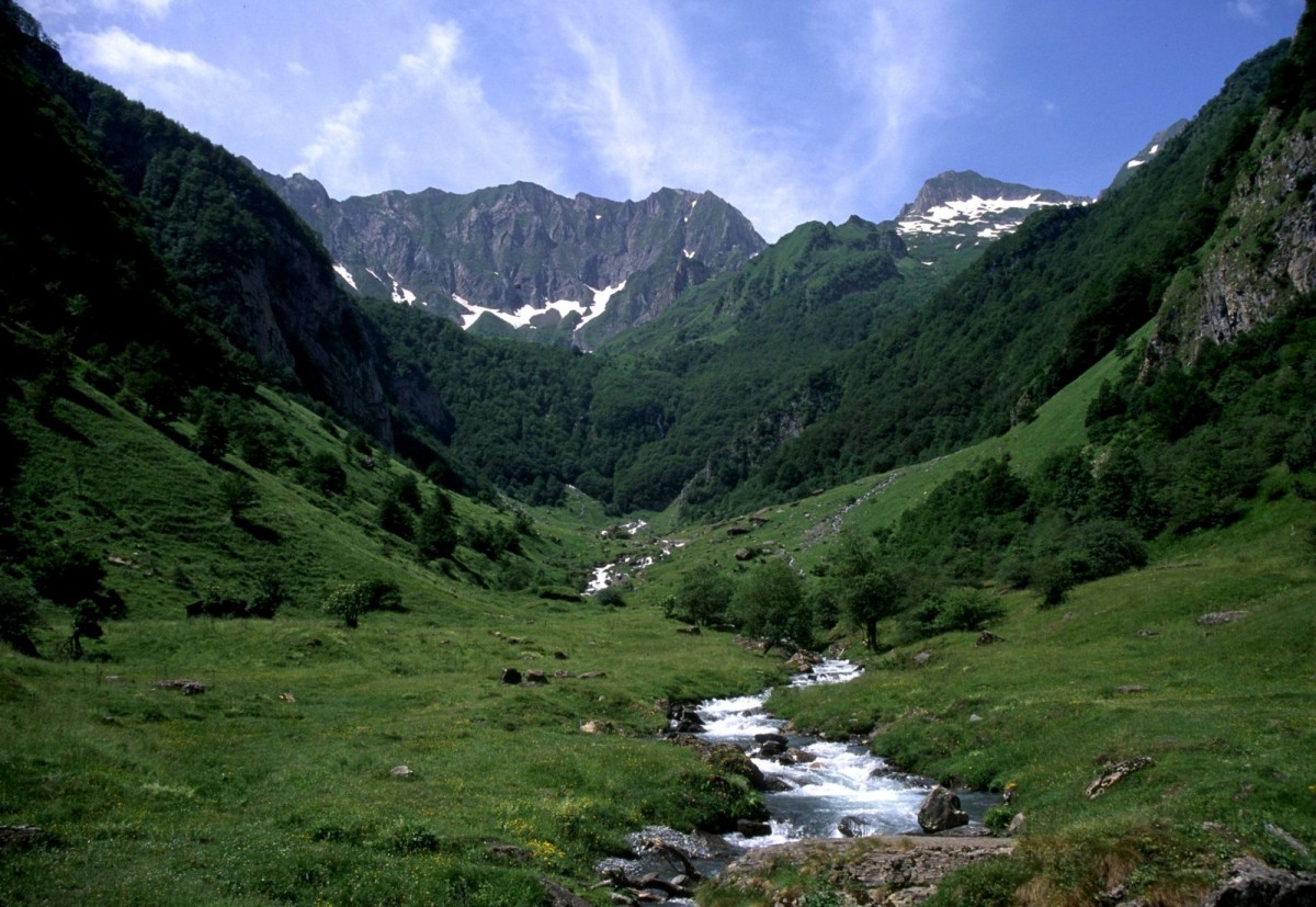
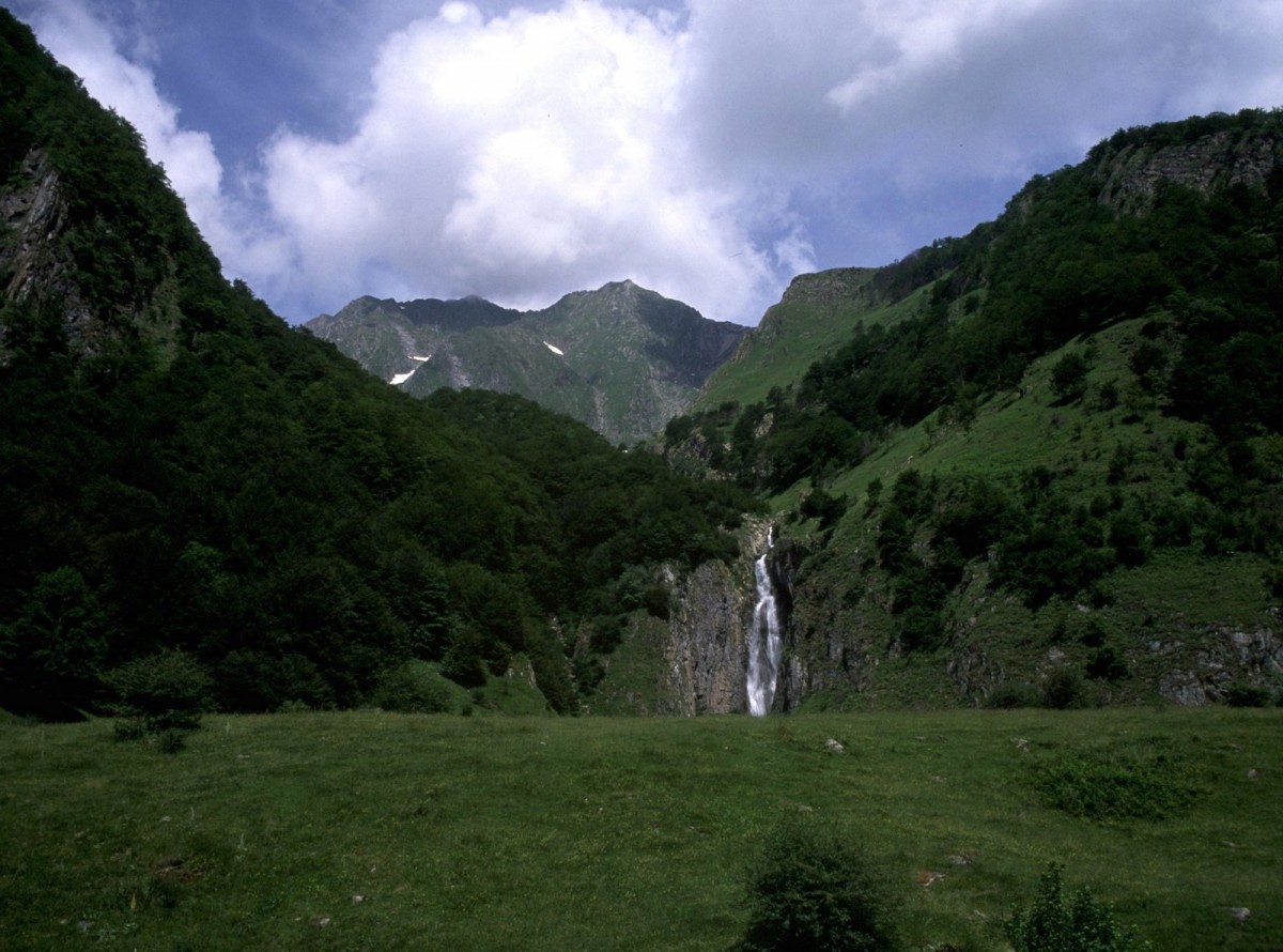
The Pyrenees are a mountain range, some 450km in length, which form a natural border between France and Spain. There are several summits in the range that are over 3000m high, including Vignemale, at 3289 metres. Weather systems, sweeping in from the Atlantic, keep the west and north facing slopes of the mountains well supplied with rain. The southern and eastern slopes are much drier due to the influence of the hot, dry weather over Spain and the Mediterranean.
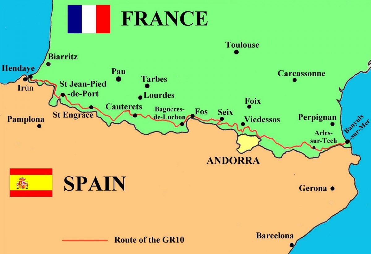
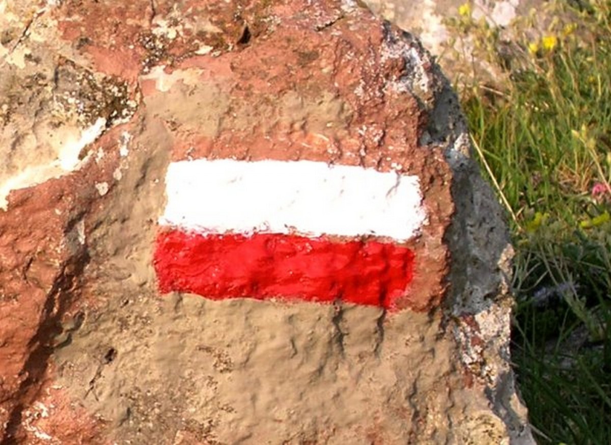
The GR10 is one of a number of long-distance footpaths that originally criss-crossed France but now extend across much of Europe. The GR10 is shorter than the Bibbulmun Track, varying between 800 to 850km total walking distance depending on the exact route taken. It may be necessary, for example, to vary the route in order to obtain supplies. However, with 49,000m of ascent and the same amount of descent, it is a much tougher walk than the Bibbulmun Track. It can be walked by a fit hiker in 50 to 60 days, but that means some 800m of ascent or descent every day. There is no let-up from the relentless ups and downs. Even on the last day there is a short uphill climb to Pic Neulos at 1286m, before the long descent to the Mediterranean.
Heavy snowfall in the mountains means that it is only possible to walk the GR10 between May/June and September/October, depending on when the first winter snows arrive. It is possible that some of the higher sections will be impassable even in early June because of snow. The trail can be walked in either direction, but if you walk from west to east (Hendaye to Banyuls-sur-Mer) you are likely to have any wind and rain on your back. If you walk from east to west you will have any bad weather in your face, particularly as you get further west.
The Pyrenean wildflowers can be spectacular in late spring and early summer and the trail can be very quiet. Once the French summer holidays start early in July, the trail is busy until early September and accommodation can be a problem. Things quieten down in early/mid September and walking then can be very pleasant with a quiet trail and settled weather.
Access to the GR10 is not difficult. There are local airports at Biarritz, Pau, Lourdes, Toulouse and Perpignan, with flights from Paris and London. From the airport it is possible to take the train or a local bus to your start point. If you are coming from Paris then a good option is the TGV which takes just over five hours to Pau.
There is no accommodation on the GR10 similar to the Bibbulmun Track campsites. It is recommended that walkers carry a good quality lightweight tent and a stove that uses one of the different types of gas canister, preferably the re-sealable type. Camping Gaz is widely available throughout France. We use a Camping Gaz Bluet 206 stove and usually carry 3 cylinders.
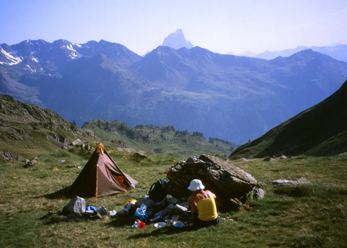
There are a number of public campsites in towns and villages along the GR10 but many of these open only in July and August for the French summer holidays. Wild camping is possible high in the mountains but is usually not allowed in National Parks. Bivouacking overnight is generally allowed and requires the tent to be put up after 7pm and removed early in the morning. Staying more than one night in the same place is not permitted, and it is important to leave no trace of your stay.
It is best to camp as high up as possible as the streams lower down may be contaminated by animals grazing higher up. However, be aware of the risks if the weather becomes thundery. It is not a good idea to be high on a mountain in a thunderstorm; every year people are killed by lightning strikes on the mountains. The second best option to wild camping is to use a shepherd’s hut or cabane. These will usually have a sleeping platform, possibly a cooking area or fireplace and a water supply, usually a nearby spring or piped water fed from a spring. Some cabanes will be padlocked to prevent casual use by hikers but many will be open. If the shepherd is in residence then you will have to look elsewhere or maybe camp nearby. Other cabanes may have two sections, a locked one for the shepherd and an open one for hikers.
Gîtes d'étapes will be found in many of the villages and towns that the track passes through. These offer basic hostel-type accommodation usually with one or two dormitories, toilets/washrooms and possibly cooking facilities. It may also be possible to buy meals, dinner (diner) and breakfast (petit déjeuner). These can be very enjoyable as they are usually very adequate, provide the opportunity to meet other hikers over a carafe of wine and help the village economy. The purchase of a lunch pack (pique-nique) for the next day’s walking may also be possible. Mountain refuges are another option when high in the mountains. Accommodation is usually in dormitories and there is usually a large dining room/common room. Meals and drinks are available and some of the bigger, popular refuges have a restaurant attached for day visitors.

Margaret and I first went to the Pyrenees to walk the GR10 at the end of May 2001. We flew to Biarritz and then made our way by public bus to Hendaye, the start of the trail. It was our intention to walk all the way to Banyuls-sur-Mer but we hadn’t fully realised what that would involve - for example, the crossing of the highest mountain pass on the entire route – the Hourquette d’Ossoue at 2734m. We started walking that day from Cauterets (913m) just before 8am and having crossed several large snowfields, we finally went over the col and into camp at the Refuge Bayssellance (2651m) at about 7pm.
During our rest day at Luz St Sauveur the weather became very stormy and wet, and we realised the inadequacy of our small tent. It was fine for one person, but barely adequate for two, and then only in dry weather. In wet weather it was impossible to cope, so we decided to abandon the walk and come back later with a better, bigger tent and continue where we had left off. We made the right decision; the heavy rain continued and a village on our intended route was partly swept away by a flash flood.
We also needed to speak more French. If you assume the French will speak to you in English, forget it. However, if you try to speak a little French, then they will make the effort and speak a little English and conversation of a sort becomes possible. At least we now had experience of the trail and of the different types of accommodation, which meant we would be better prepared for the next attempt. We knew how tough the trail was with the big climbs, descents and long, tiring days. However we also appreciated how beautiful the Pyrenees were, which gave us the incentive we needed to return.
So at the end of May 2003, we returned to Luz-St-Sauveur to resume our hike, with the intention of completing the walk before the start of the French holidays. To get us into the swing of things, we had to climb to the Col de Madamète (2509m) on the second morning after rejoining the trail at an altitude of 720m—just under 1800 metres of ascent in the first 24 hours! To make matters worse, we had to make camp in a thunderstorm on the first afternoon with everyone else running down off the mountain and shouting to us “Go down! Go down!” There was still a lot of snow high on the mountains, particularly on north facing slopes, and the trail ahead had been broken by only one or two hikers ahead of us.
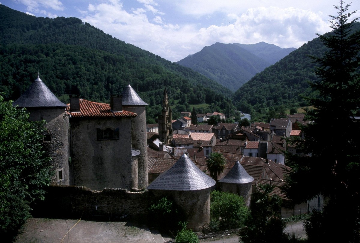
Our efforts at learning French proved very useful when we met Marcel, Lydie and Katherin on the trail. We became good friends and are still in touch with them. The sixth day of this first section proved very tough and we finally staggered through Bagnères-de-Luchon at 7pm with a mile still to go to reach the campsite. Margaret discovered here that her boots were finished but luckily she was able to purchase a new pair which gave excellent service without being walked-in.
It had become apparent to us by now that we would not be able to achieve our objective in time, and that we needed to adopt an easier schedule. We therefore made the decision to have a day off every four or five days and to end our walk at Mont-Louis, from where there was a bus service to Perpignan. This would leave a section of about ten to twelve days hiking to tackle at a later date. We were now more confident of our abilities and our equipment. We were using a mix of gîtes d'étapes, public campsites and mountain refuges for our accommodation, together with wild camps and shepherd’s huts, which were our favourites.
We finally walked into Mont-Louis on schedule to travel to Perpignan for our flight home, having survived three very scary thunderstorms while camped high in the mountains. However, the walking had been magnificent and we knew we would be back to finish the job.
And so it was, on June 1st 2005, that we flew out to Perpignan to start the last section. By midday on the 2nd June we were on the track and heading for our first campsite. The weather was fair and the spring wildflowers were stunning. The walking was the same mix as before, mostly long ups and downs with occasional short stretches on the flat. We started at La Cabanasse (1500m) and on the second and third days we had to cross two cols at almost 2300m. We made steady progress using the same mix of wild camps, shepherd’s huts and gîtes d'étapes and suddenly it was the last night on trail.

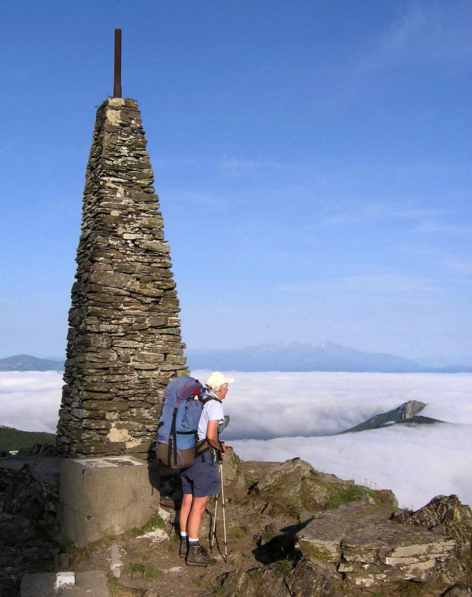
The morning dawned fine and we set out up the last big hill to the summit cairn of Pic Neulos at 1256m, before starting the long downhill walk to the Mediterranean. As we got nearer to our destination the weather became hotter with the sun more persistent and then finally we could see the town of Banyuls-sur-Mer ahead. After what seemed like an eternity we walked onto the beach and dipped our feet in the sea before hugging each other in celebration. Sunbathers on the beach looked a little agog at these two hikers with all their gear but a few, who knew what we were celebrating, smiled in admiration.
Our sense of achievement in completing this very tough walk was tremendous. It has to be remembered that it does not just require physical fitness but also determination and planning. You have to keep saying, “get up, get on, and keep going!” If you can’t do this, you won’t complete the walk. You also need to research your walk and plan carefully. You need to know where you can buy the next provisions and how much to buy, and you need to know where you are going to stay each day. The highlights of the walk were numerous; the fabulous mountain scenery, the wildflowers, the high camps on the mountains, the wonderful French bread and finally, walking the last 50 metres onto the beach at Banyuls-sur-Mer. And to think, this all started because I saw a book Trekking in the Pyrenees in a bookshop in Thamel, Kathmandu and bought it thinking it looked a good idea!
Would we do it again? Yes!